Luang Prabang Mekong Dam Hydropower Info - by Hobo Maps - Go Back to Hydropower Web Page - - - HOME
The Luang Prabang Dam hydropower project site is located on the Mekong River about 25 km upriver from Luang Prabang town near Ban Houaygno and 4 km upriver from where the Nam Ou river joins the Mekong River. The project impacts Chomphet district in Luang Prabang province, Hongsa district in Xayabury province and Nga district in Oudomxay province.
Luang Prabang Dam site coordinates are 20°04'24.7"N 102°11'15.0"E (20.073528, 102.187500) as shown in satellite images below during construction:

Good close-up video of massive dam construction 2 Sept. 2026
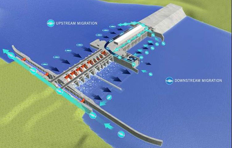
Concept image of what Luang Prabang Dam is designed to look like below:
In March 2022, Thailand energy authorities announced that EGAT would soon sign a power purchase agreement (PPA) for offtake of the project's power production. Later unconfirmed reports state that a formal PPA was signed and issued on 7 November 2022. However the Thai government has not seemed to have made a formal confirmation of this.
The project is designed to have installed capacity of 1,460 MW with yearly average output capacity of 6,854 GWh. It will operate under a concession agreement for a period of 32 years from the Commercial Operation Date.
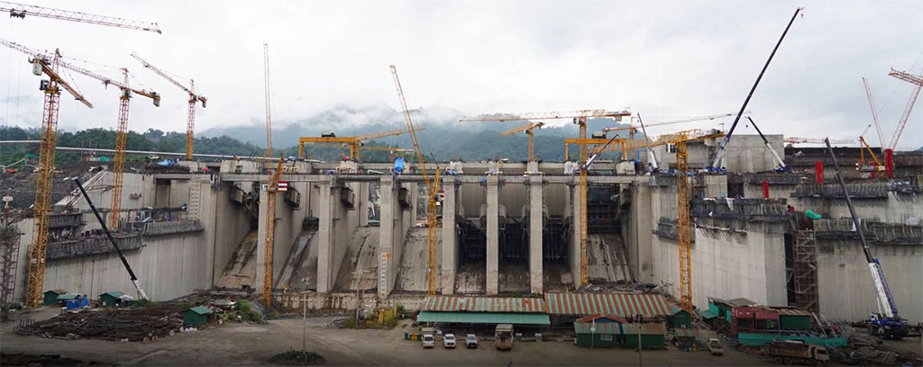
Construction began in 2022 and was reported to be overall 72 percent complete as of the July 18, 2026 during a joint ministerial site visit. Construction progress is evident on the main dam structure where work has advanced to the point that river traffic can continue to pass through the area normally. Foundation construction was currently underway after which the river flow will be diverted to enable work on the remainder of the dam.
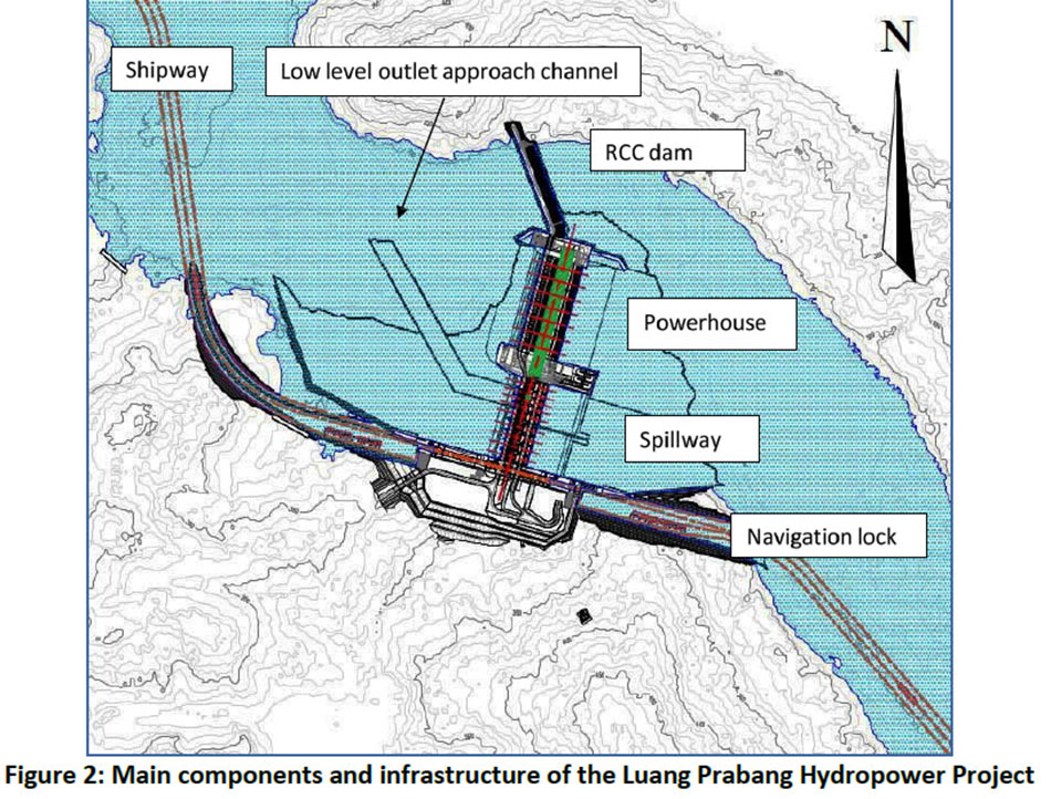
Proposed layout of Luang Prabang Dam site below:
Luang Prabang Power Company Limited is developing the project under an old Memorandum of Understanding between the Government of Lao PDR and PetroVietnam Power Corporation. Thai-based Ch. Karchang Company, which built the Xayaburi Dam, is in charge of construction.

The main EPC Contractor for construction works is CH. Karnchang (Lao) Company Limited.
The main Turnkey Contractor for Environmental Management and Resettlement Action Plan (RAP) works is Phornsavarn Development Sole Co., Ltd.
Developers include Xayaburi Power Company Ltd. and PetroVietnam Power Corp..
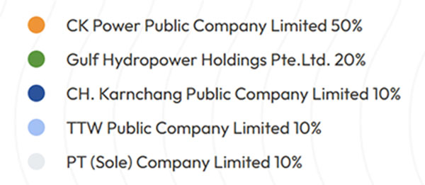
Thailand’s CK Power Public Company Limited is the largest shareholder with a 50 percent stake, followed by Gulf Hydropower with 20 percent. CH. Karnchang, TTW Public Company and Laos’ PT Sole each holding 10 percent.
The project is expected to cost about US$ 3 billion. On 29 April 2026, CK Power Public Company Limited (CKPower) announced it had successfully issued 5 billion Thai Baht in green debentures with the funds earmarked for construction of the Luang Prabang dam.
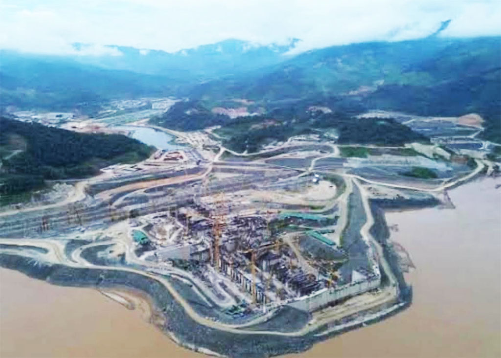
July 2026 construction image below when it was reported that the project was 72% complete.
Luang Prabang Dam construction site satellite image below in 2022:
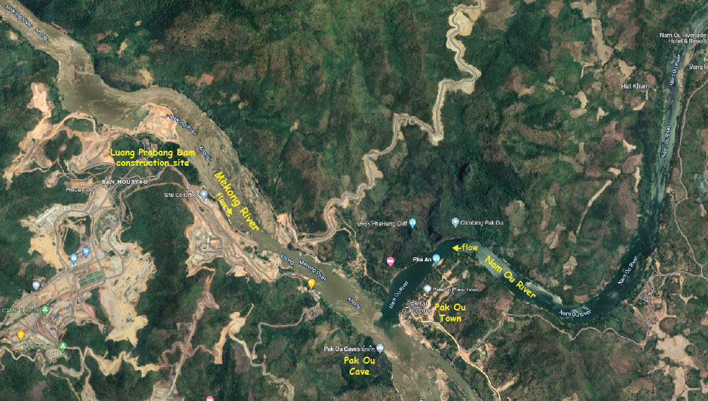
The main structures of the project are a navigation lock, spillway, powerhouse and dam structure. The dam crest elevation is 317 meters above mean sea level while the maximum dam height is about 79 meters over the deepest foundation.
A lock system will enable 500-ton cargo vessels and passenger boats to pass through the dam in approximately 40 minutes. The dam has also been engineered to withstand earthquake-related vibrations in line with international safety standards.
A fish pass system for upstream and downstream fish migration with multiple entrances is to be located by the powerhouse as well as in the left pier, right pier and on the right riverbank along the navigation lock. The fish migration system will be integrated into the powerhouse structure, the intake channel and the tailrace channel.
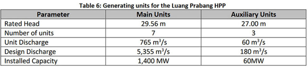
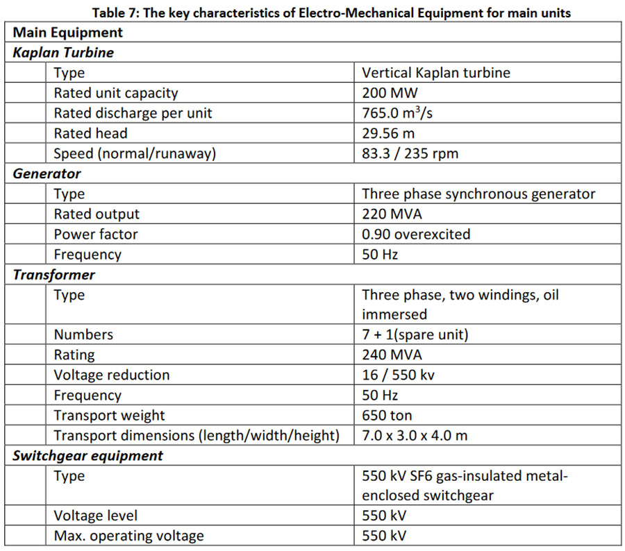
In January 2023 Andritz Group was selected to supply the hydro-mechanical package that includes design, manufacturing, supply, transportation, erection, testing and commissioning of seven large Kaplan turbine-generator units (200 MW output each) and three smaller units (20 MW each) including transformers, governors, control, excitation and protection and SCADA systems as well as the electrical power and associated auxiliary systems.
Construction progress image below in 2026.
The Project is designed as a run-of-river project with a barrage-type dam comprised of:
- A powerhouse equipped with seven Kaplan turbine/generator sets with total installed capacity of 1,400 MW and a maximum gross head of 36.80 meters
- Auxiliary turbine/generator units using water flow from the fish migration facilities provide a further 60 MW capacity
- A spillway structure with six radial surface gates
- A two-step navigation lock system for up to 500 ton vessels.
- A fish pass system for upstream and downstream migration.
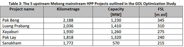
At Full Supply Level (FSL) of 312 meters above sea level the Luang Prabang reservoir backwater will extend approximately 75 km upstream of the barrage almost to the planned Pak Beng Dam site. The FSL operating range will normally be maintained between 312.00 and 312.50 masl.
As a Run-of-River type hydropower plant, the reservoir will be maintained steady for most of the time during operation and will only vary during spillway operations or other exceptional operating cases.
During flood operations, the three low-level outlets and six surface spillway bays will discharge excess water. When the capacity of the low-level outlets is reached, the surface spillway will start operation. All gates of the Surface Spillway will be equipped with flap gates to allow spill of floating debris into the tail water.
Mekong River Commission Secretariat September 2019 PDF - LPB Dam Features
The dam structure is a Roller-Compacted Concrete gravity dam with a height of 53 meters above foundation level and an overall length of 281 meters. The dam crest elevation is 317 meters above sea level and the foundation level is at 264 meters above sea level. The width of the crest is 12 meters.
Spillways: The spillway overflow consists of six high-level surface bays at 288 masl and three sediment-flushing low-level outlets at 275 masl. Each of the surface bays is equipped with a Gantry crane, flap gates (to allow floating debris to overflow into the tailwater area) and a service gate (radial gate) operated by hydraulic cylinders.
The surface spillways have a design discharge capacity of 4,850 cubic meters per second while the low-level outlets have capacity of 3,530 cubic meters per second. The spillways are designed to accommodate a 10,000-year flood (same as the the existing Xayaburi Dam design).
Navigation Lock: The navigation lock is at the right riverbank and uses a two-step system for transit of vessels up to 500 tons by dividing the total lifting height of 35.5 meters into two equal parts. The time for transit through the two-step ship lock is expected to be about 50 minutes and may provide additional fish passage during migration periods.
Fish Migration Facilities and Impacts: The project design includes fish migration facilities to sustain the life cycle and populations of long distance migratory white fish species found in the upper zone of the Lower Mekong Basin. Upstream and downstream fish migration systems will be integrated into the powerhouse structure, intake channel and tailrace channel.
Downstream fish migration through the powerhouse: A collecting gallery installed above the powerhouse intakes and a downstream stepped chute (exit chute) to the tailrace channel will be built to support fish migrating downstream. Mortality for smaller fish through the turbines will be minimized due to the turbine design while larger fish will be diverted by the trash racks to the collecting gallery. Fish migration will also occur via the spillways when they are in operation.
The upstream migration system comprises multiple entrances along the powerhouse, a collecting system and two fish locks at the left pier with outlets into the headwater. The downstream migration facility provides entrances above the power intakes where fish are spilled via a stepped downstream chute at the right pier into the tailwater. The water from the attraction flow is used for electricity generation at the auxiliary units.
Upstream fish pass facilities include fish locks at the powerhouse and multiple entrances along the downstream face of the powerhouse and at the left pier. Fish in these collection galleries are guided by attraction currents to two parallel fish locks, including a fish crowder and movable screen floor, where the fish are lifted up into the headwater of the reservoir.
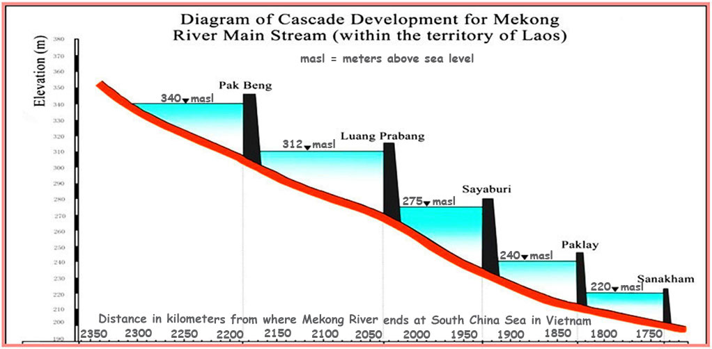
Mekong River water level chart below for Mekong at Luang Prabang town. Current water level at 276 masl in Nov. 2022 matches the backwater full supply level of 275 masl for Sayaboury Dam HPP and shows that the backwater pond does reach all the way to L. Prabang. Updated chart from Mekong River Commission website page can be seen HERE.
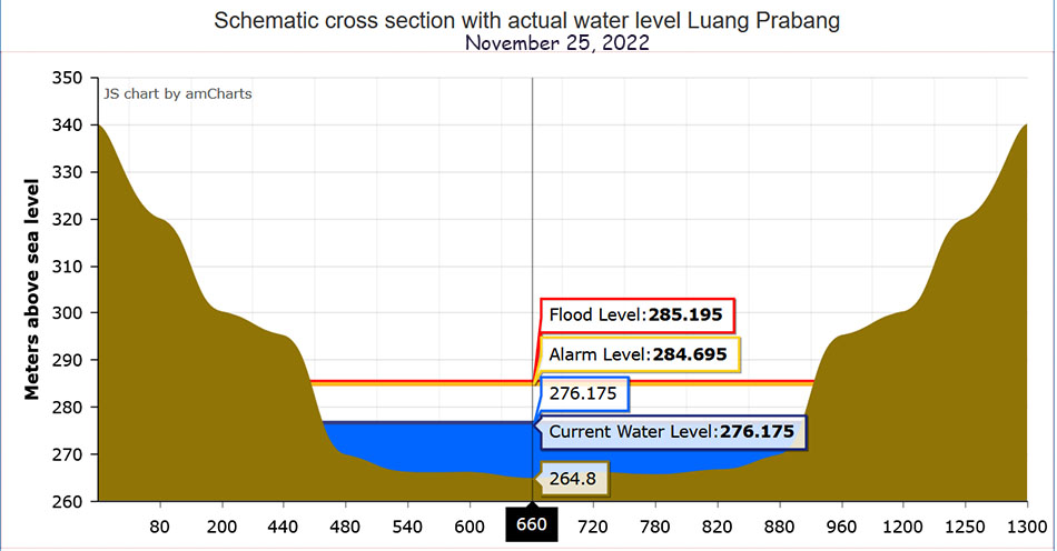
Maybe it's a good time to prepare a flood emergency plan:
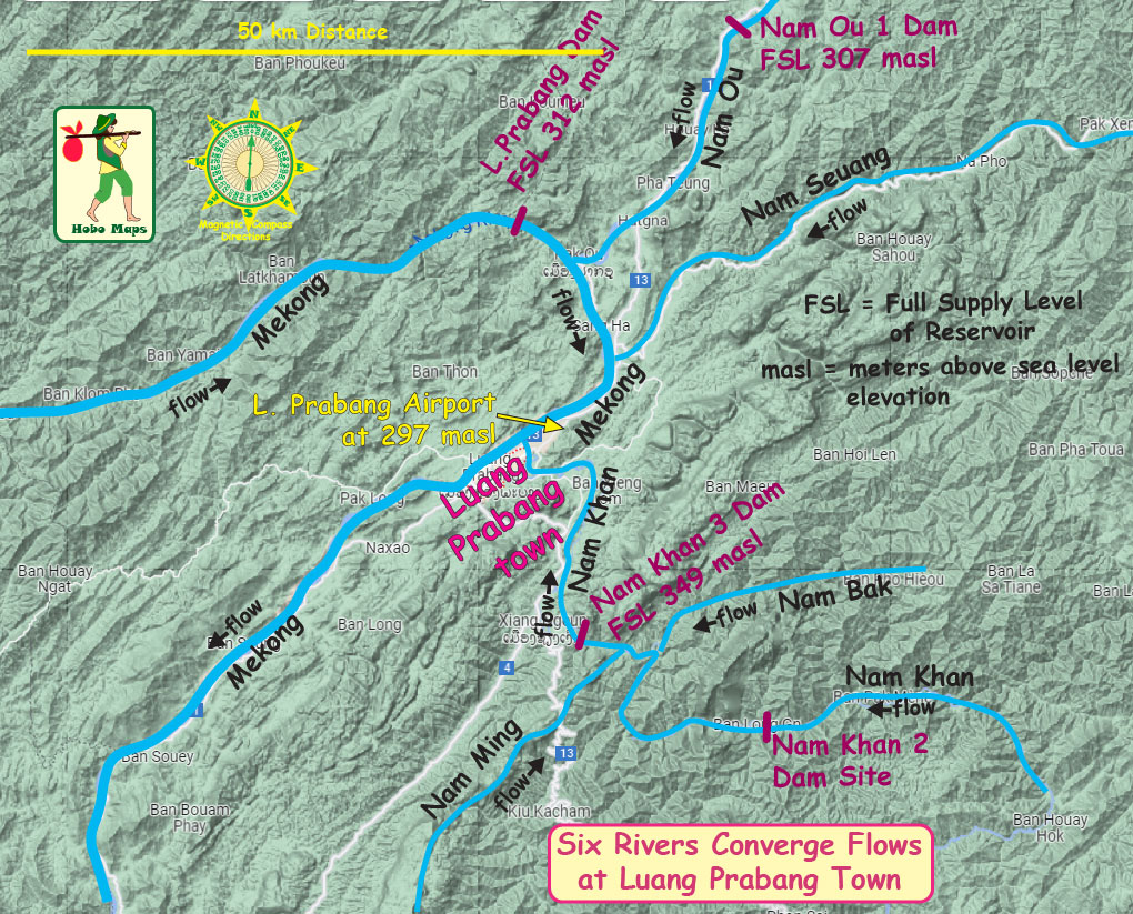
See our flood maps web page that shows estimated impacts for various levels of flooding in L. Prabang area HERE.
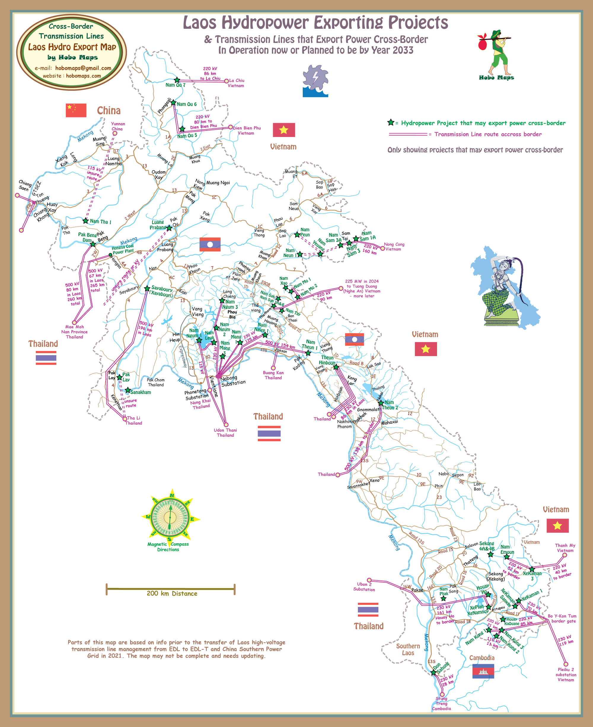
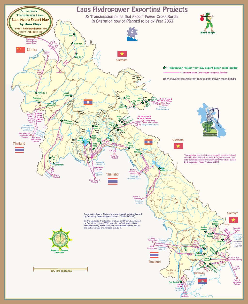
Luang Prabang Dam hydropower project has received an agreement from Electricity Generating Authority of Thailand (EGAT) to purchase output from the project but details are not yet clear and the transmission line export route has yet to be disclosed. The export map below shows a possible route along with other export lines. See a larger version of this map HERE.
The project construction may displace 581 families ( 2,285 people) and impact 20 villages.
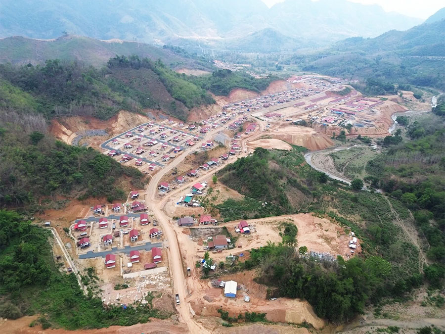
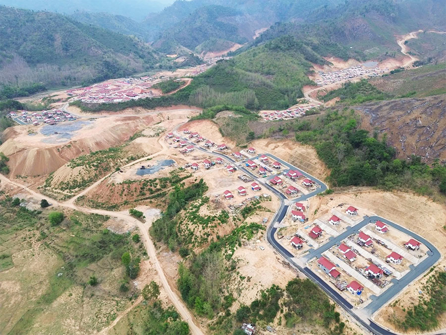
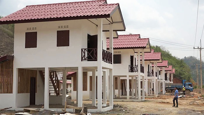
May 2026 relocation images below of new housing for displaced residents of Nga District in Oudom Xay Province.