Nam Ngiep 3A Dam Hydropower Info by Hobo Maps - Go to Hydropower Projects Page - - Home
Nam Ngiep is pronounced like "Nam Nyiep".
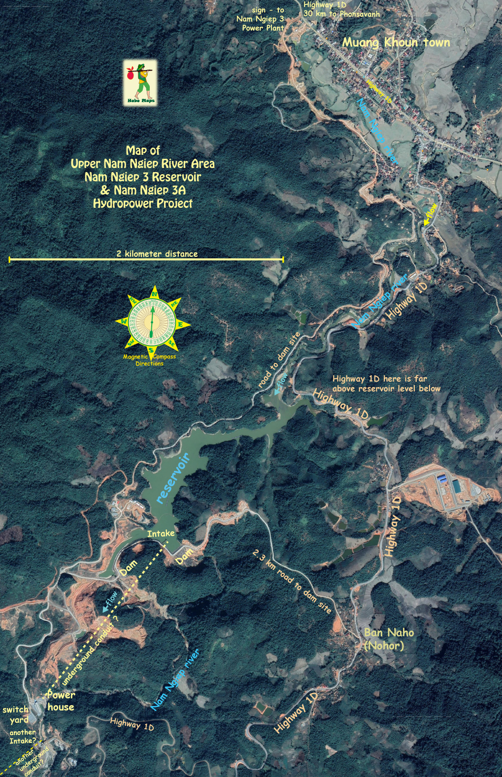
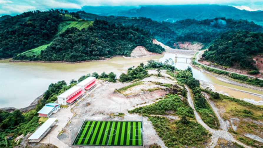
Nam Ngiep 3A hydropower project is located on the upper area of the Nam Ngiep river that has its source at the Plain of Jars area in Xieng Khouang Province, Lao PDR.
Nam Ngiep 3A Powerhouse (bottom left corner of map below) is at coordinates - 19°17'23.0"N 103°20'30.0"E (19.289722, 103.341667)
The reservoir main dam structure and intake coordinates are - 19°17'59.6"N 103°21'06.5"E (19.2999, 103.3518)

Tthe Nam Ngiep river below the dam seems dry so the intake structure must be taking nearly all of the outflow from the reservoir into an underground conduit to the Nam Ngiep 3A powerhouse.
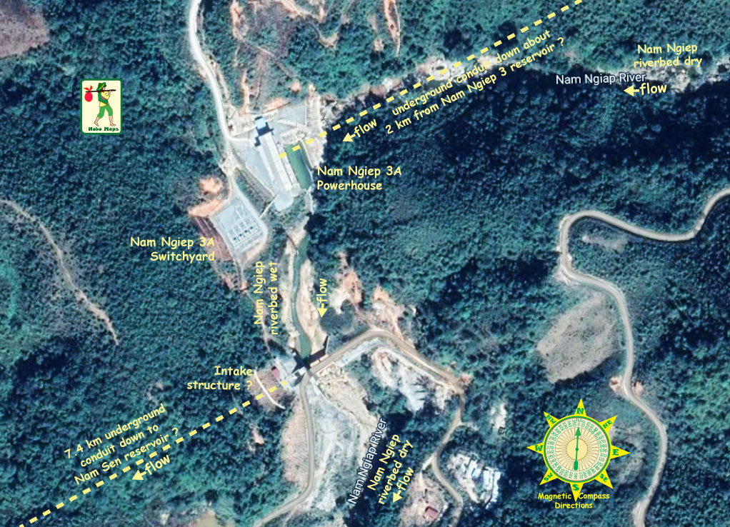
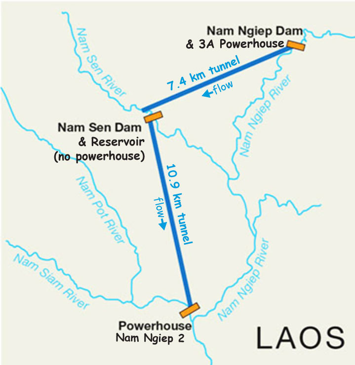
Another intake structure just below the Nam Ngiep 3A powerhouse takes nearly all of the water out in an underground conduit 7.4 km southeast down to the Nam Sen Reservoir on the Nam Sen river.
At the Nam Sen Reservoir water flows into another intake structure and goes down a 10.9 km underground conduit to the Nam Ngiep 2 powerhouse located close to where the Nam Siam river joins the Nam Ngiep river and also close to the Na Ao Nam Pot HPP.
Larger scale satellite image of Nam Ngiep 3A powerhouse area below:
Nam Ngiep 3A Hydropower project is located on the Nam Ngiep River near Nasy Village, Khoun District, Xieng Khouang Province about 64 km southeast of Phonsavanh.
The Nam Ngiep (river) originates in the Plain of Jars area and flows southeast joining the Mekong river near Paksan, Laos.
Phongsubthavy Bridge-Road Construction Co., Ltd. was the main contractor for the project and after completion in 2015 sold the project to TK Group Co., Ltd.
Chaleun Sekong Power Co., Ltd. is now the 100% shareholder and owner after purchase in 2016 from TK Group Co., Ltd.
The project cost was US$ 102 million.
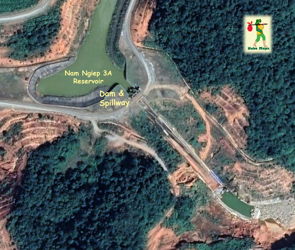
The coordinates for the Dam & Spillway below are - 19°17'53.5"N 103°20'52.8"E (19.298194, 103.348000)
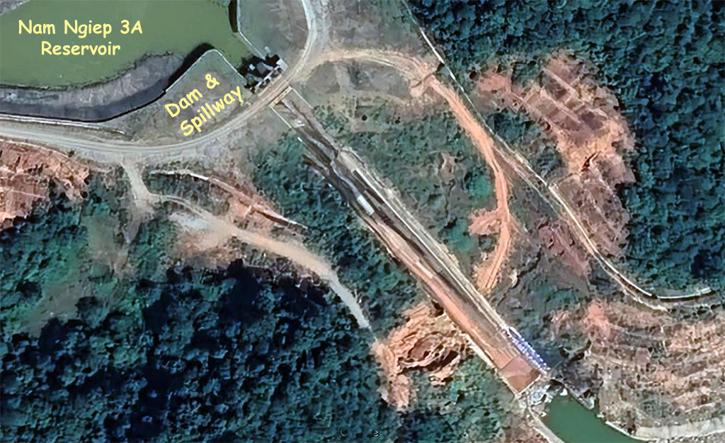
The project includes main dam, spillway, intake structure, headrace channel, penstock, power house, switchyard and tailrace channel.
The project turbines were supplied by China-based Dongfang Electric Corp.
Map below shows the long underground tunnel conduits diverting water from Nam Ngiep river after it leaves the Nam Ngiep 3A powerhouse.
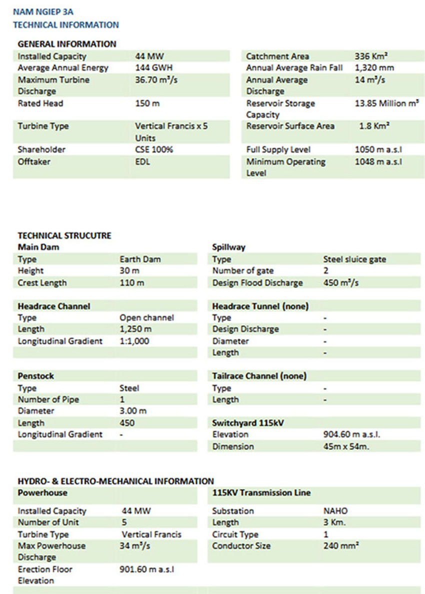
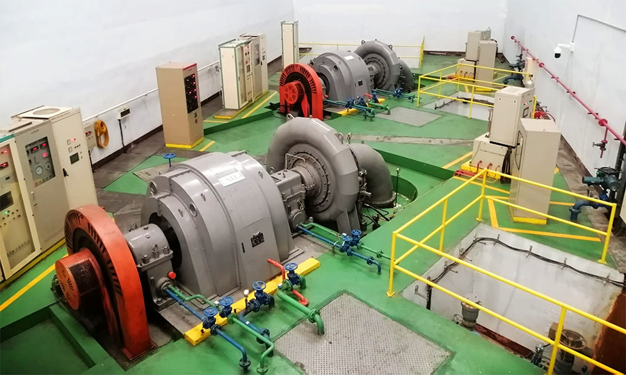
The project has 3 units of 13 MW vertical shaft Francis turbine and generator sets and 2 units of 2.5 MW horizontal generator sets. The installed capacity of the project is 44 MW with annual power output capacity of 153 GWh.
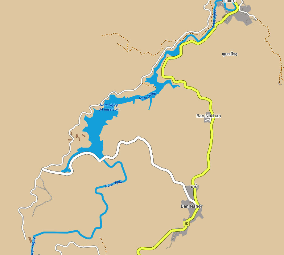
The Dam and Powerhouse are located west of Highway 1D as the road goes south from Muang Khoun and the Plain of Jars area. The access road goes about 2.3 km west from Ban Naho on Hwy 1D to the dam site. The Powerhouse site is about 2 km southwest of the Dam site on a direct route where there apparently is an underground conduit carrying water from the reservoir to the powerhouse.
Nam Ngiep 3A Hydropower Project images below:
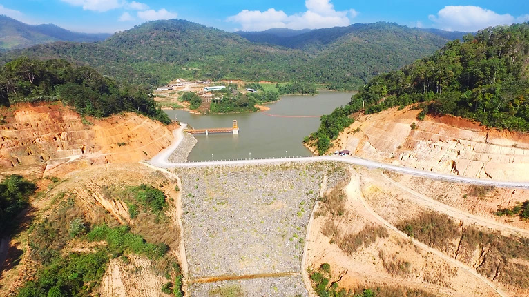
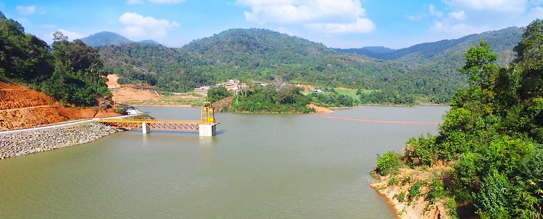
Dam & Spillway image below with release gates.
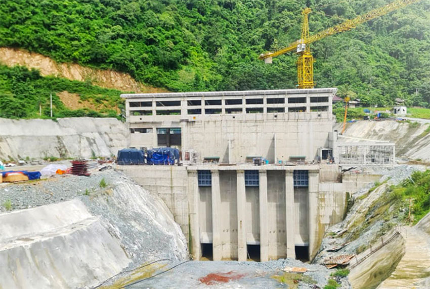
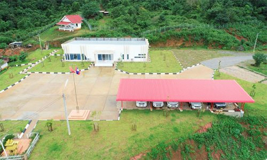
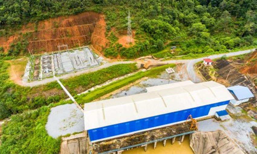
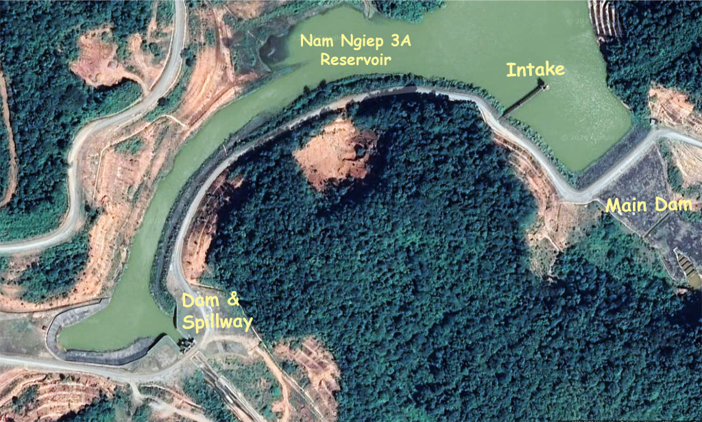
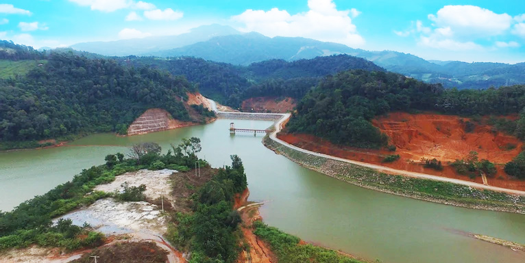
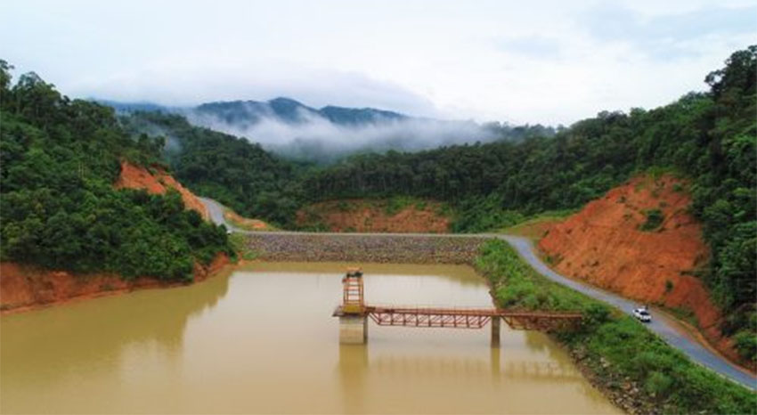
Nam Ngiep 3A Saddle Dam image below with intake structure.
The project history below from CS Energy website
Construction Contractors:
Phongsubthavy Bridge-Road Construction Company Limited: Detailed design: Construction of earth fill dam, Bottom outlet, canals, Spillway and Intake.
Construction control (Supervise construction) TUGBOAT TEAM COMPANY LIMITED.
Construction of Penstock, Spillway and Bottom Outlet: T-RAX Steel Co., Ltd.
Construction of 115 kw transmission line and Structural work of Switchyard: Tonnam Energy Ltd., Part.
Construction of Powerhouse: R.L. Corporation Co., Ltd.
Dongfang Electric International Corporation - Supply and installation of electrical and mechanical systems in Powerhouses and Switchyard.
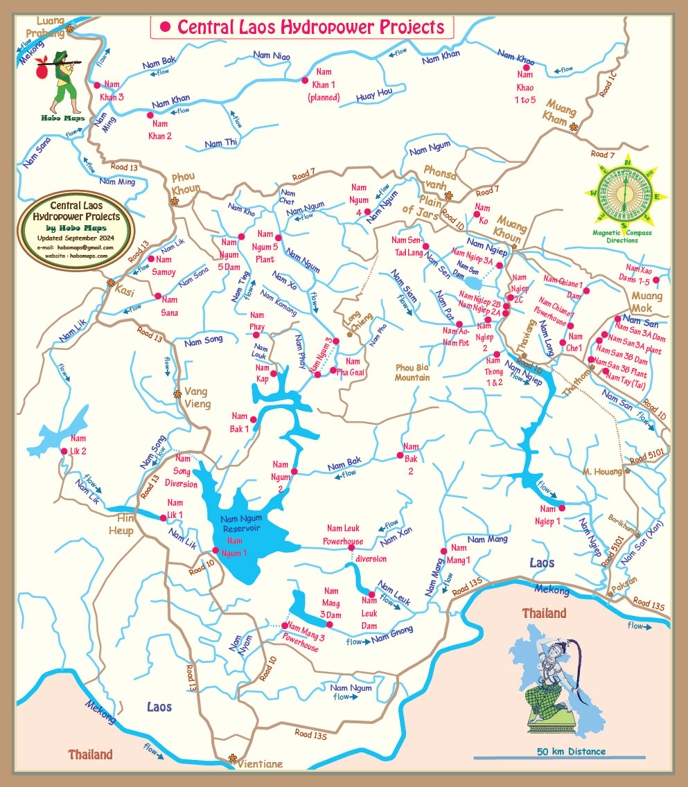
Nam Ngiep 3A project shown on mid-right area of map below:
Nam Ngiep 3A controls images below:
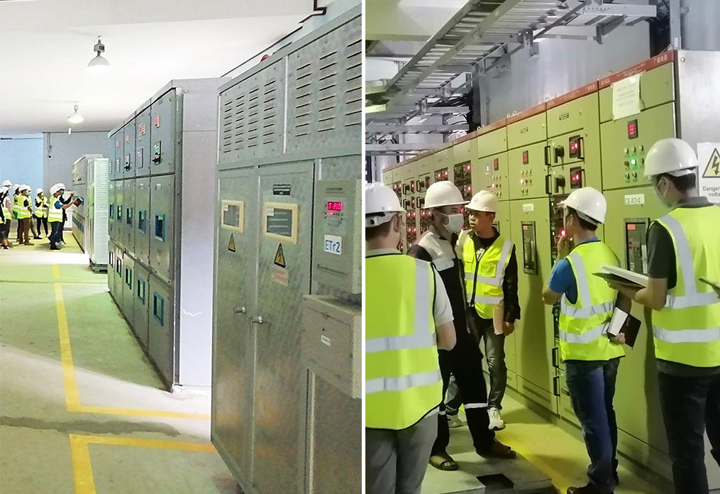
Nam Ngiep 3A powerhouse area images below:
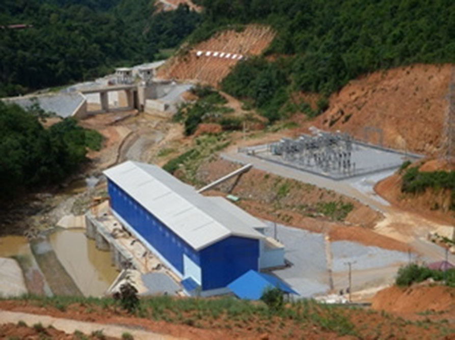
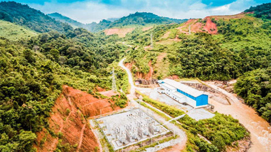
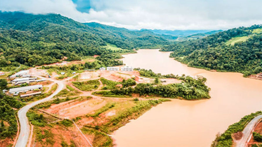
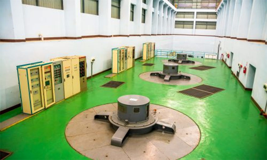
Nam Ngiep 3A powerhouse interior below:
Nam Ngiep 3A reservoir & Road 1D outlined below.
Nam Ngiep Catchment area with dams shown below:
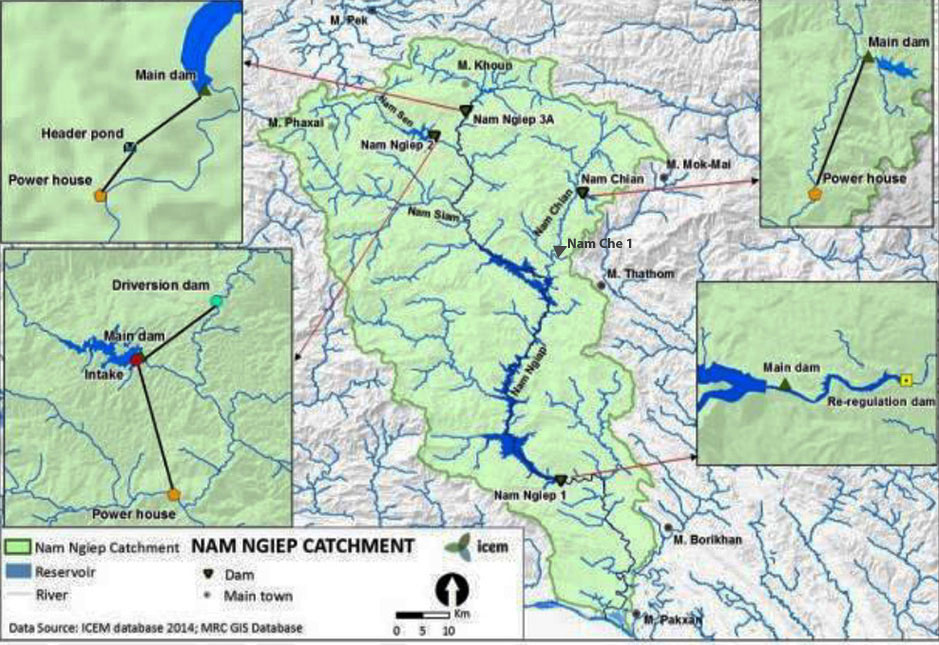
Click HERE to see our hydropower web page for the greater Nam Ngiep catchment basin area which describes the various dams, reservoirs and diversion projects in the drainage basin which are often inter-connected.
Nam Ngiep 3A Hydropower project was originally a clean green project qualified under the Kyoto Protocol as a greenhouse-gas-reducing project and was estimated to reduce carbon dioxide emissions by about 85,000 tons per year. This qualifies it as a Clean Development Mechanism (CDM) project and able to earn CO2 reduction credits. View or download CDM application document HERE . But beware that there is conflicting info on this document that has geographic coordinates 19°17’23’’N, 103°20’30’’E showing the power plant as being about 40 km from Phonsavanh while in other places saying the project is 64 km from Phonsavanh.
Additional water sources and supply for Nam Ngiep 3A power production are reportedly being sought after actual water flows into the project in the early years were less than expected. In year 2022 we can see on satellite images a new dam and reservoir on the Nam Ko river which is a tributary into the Nam Ngiep river close to its headwaters near the Plain of Jars. See our web page for Nam Ko Xieng Khouang Dam.
We suspect the Nam Ko project may be sponsored by stakeholders of the Nam Ngiep 3A project. Any additional water flowing through the Nam Ngiep 3A system would eventually flow into other hydropower plants further downstream on the Nam Ngiep river so the Nam Ngiep 1 and 2 hydropower projects may also be involved in developing the Nam Ko reservoir as a water-retaining system to add flows into the Nam Ngiep during the dry season. Pure speculation at this time.