Nam Ngum 3 Dam Hydropower Info by Hobo Maps - Go to Hydropower Projects Page - - Home
Nam Ngum is pronounced like "Nam Nyum".
The Nam Ngum 3 hydropower project was revised with new developers and contractors around year 2013 and info on the internet prior to then may be outdated and misleading. The old project was 440 MW capacity while the new revised version is 480 MW with 2,345 GWh annual output potential.
The project spans three districts across two provinces – Phoukoud district in Xieng Khuang Province and Anouvong and Long Chieng districts in Xaysomboun Province.
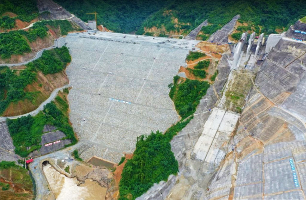
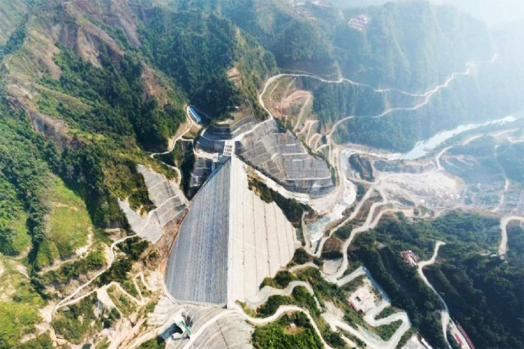
Nam Ngum 3 Dam images below:

Nam Ngum 3 Power Company Ltd. is the owner and developer of the project - a company originally owned by Electricite Du Laos (EDL 20%), Charoen Sekong Energy Company (CSE 55%), and EGAT International Company (EGATi 25%).
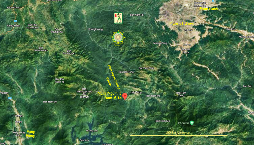
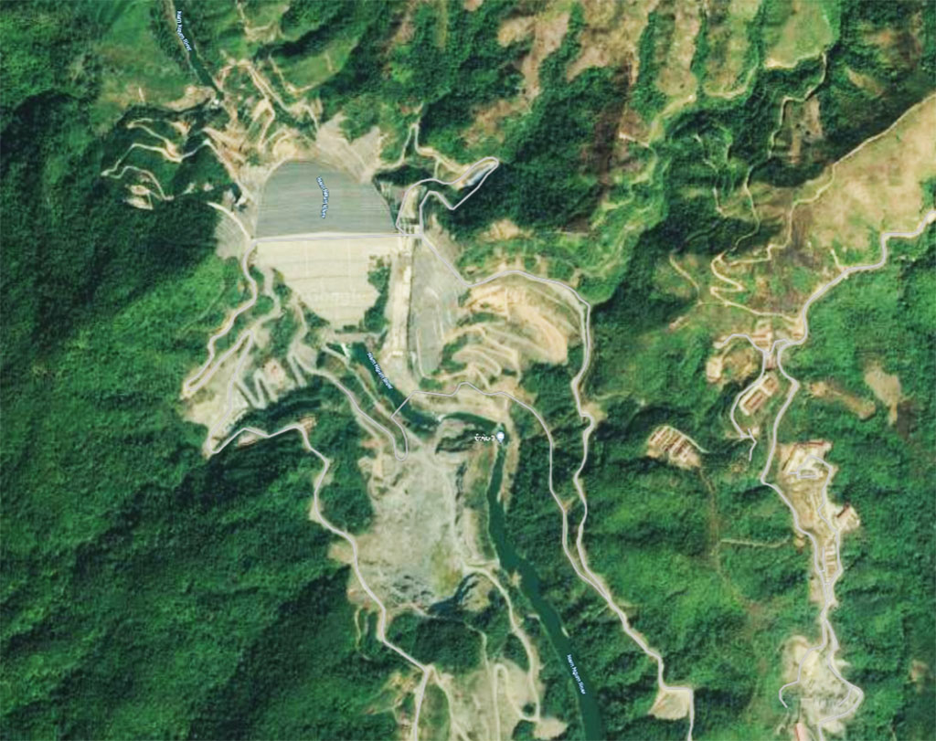
Nam Ngum 3 Dam location shown in image below at coordinates - 19°04'58.8"N 102°52'40.8"E (19.083, 102.878)
The Nam Ngum 3 project is a Chinese-funded 480 MW hydroelectric power project constructed by mostly Chinese contractors that was still under construction in 2025. The project was designed and contracted by Power Construction Corporation of China. Sinohydro International Engineering Company is the engineering, procurement, and construction (EPC) contractor for the project.
Construction began in November 2013 and the Commercial Operation Date is planned to be in early 2027. The project will operate under a concession period of 27 years.
Estimated cost of the project is US $1.4 billion with funding from China EXIM Bank.
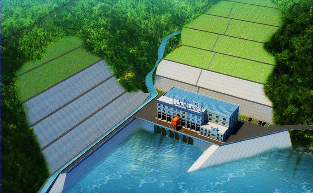
Concept image below of what Nam Ngum 3 powerhouse is planned to look like:
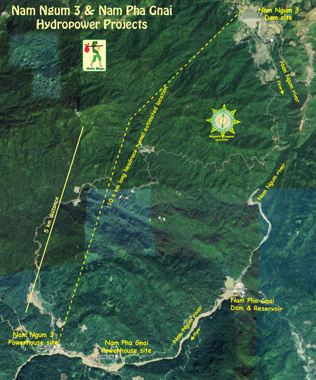
Nam Ngum 3 and Nam Pha Gnai projects layout map below - the powerhouses are not far apart:
Nam Ngum 3 (NN3) hydropower project has a 220-meter-high arch dam located on the Nam Ngum (river) 10 km west of Ban Long Chieng, Long Chieng District, Xieng Khouang province, Lao PDR. The dam structure is one of the highest of its type in the world and the highest in Laos.
The dam structure is about 4.5 km upstream from the confluence of the Nam Pha with the Nam Ngum River.
When the Nam Ngum 3 project goes online it will divert water from the Nam Ngum river into an underground tunnel and down to its powerhouse located near the Nam Ngum river downriver from where the Nam Pha Gnai hydropower project is located. This will cut-off and drastically reduce the flow from the Nam Ngum river into the Nam Pha Gnai project.
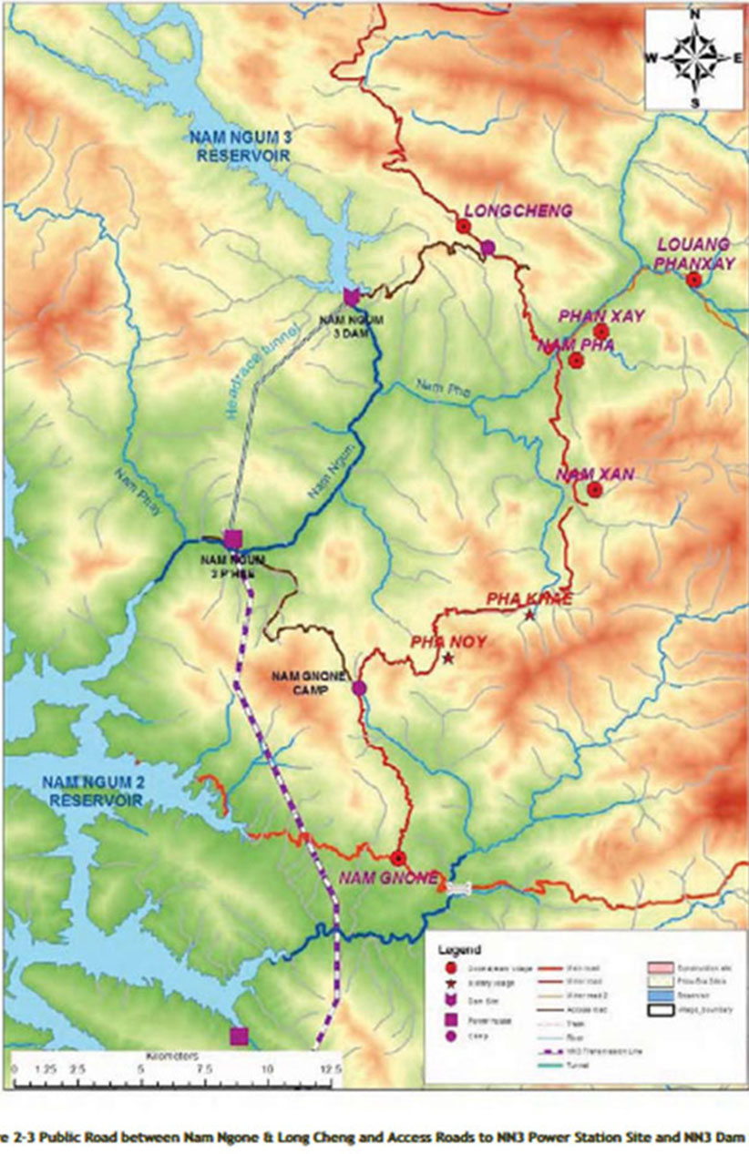
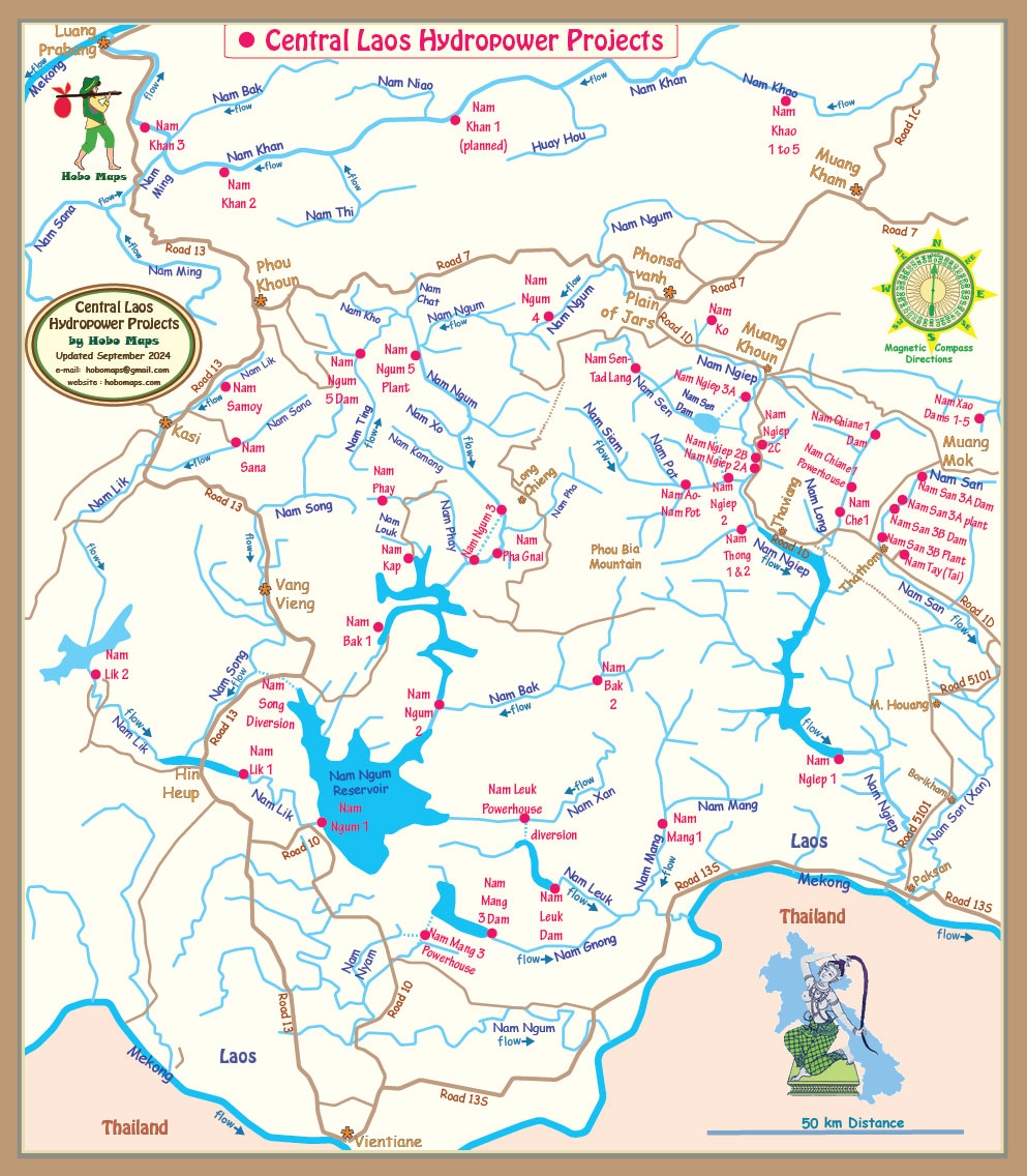
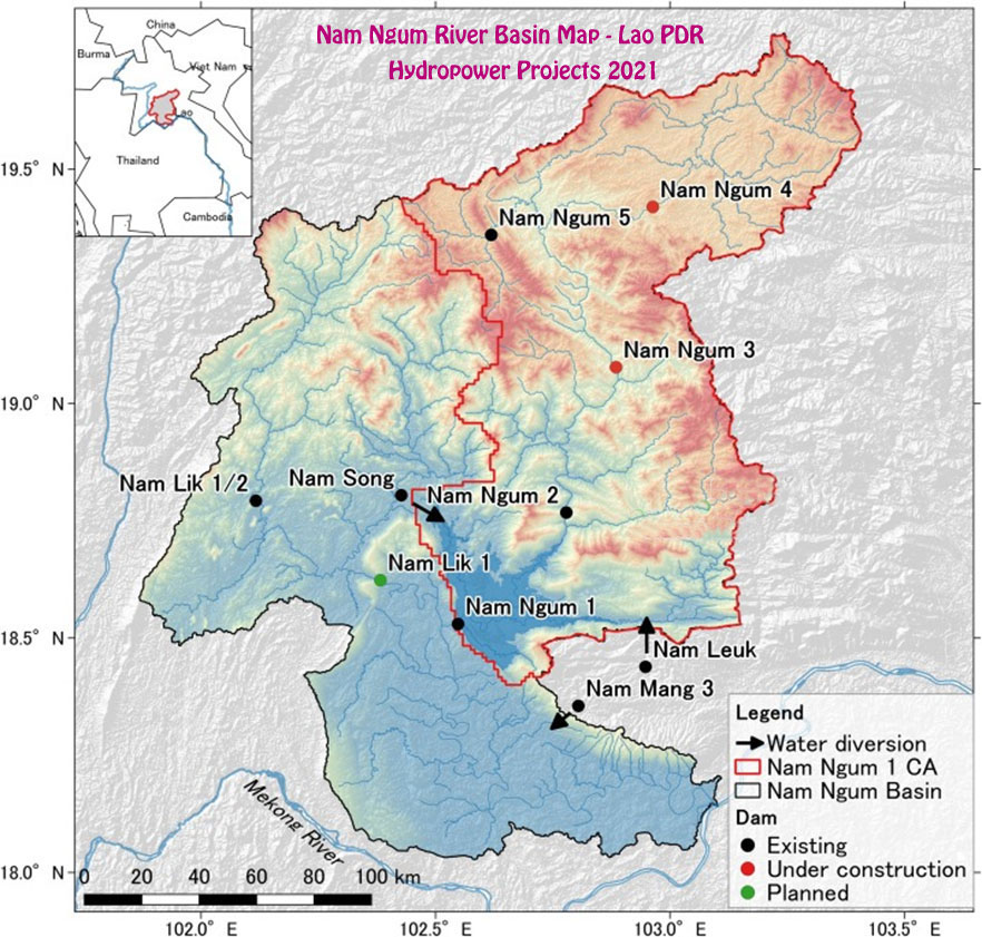
Nam Ngum 3 is located upstream of the Nam Ngum 2 Reservoir as shown below:
The 480 MW hydropower facility will be capable of generating up to 2,345 GWh of electricity annually.
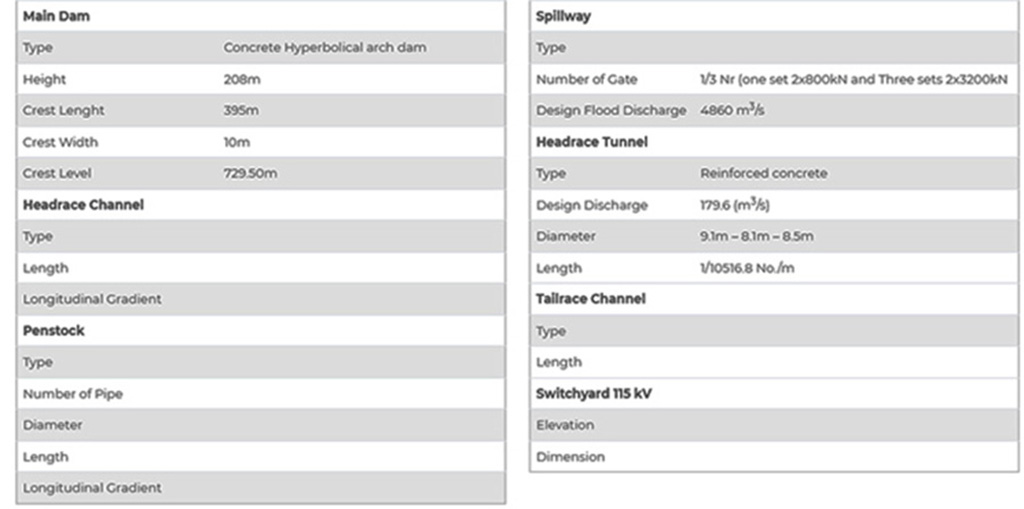
The project's concrete-faced rock dam is 210 meters high, 10 meters wide with a crest length of 395 meters.
The dam has a spillway and three radial gates - each 14.5 meters wide and 18 meters high.
The water diversion system includes a 10.5 km-long reinforced concrete headrace tunnel 9.5 meters in diameter, a 240 meter-high surge shaft with an inner diameter of 15 meters and a 1,623 meter-long pressure shaft.
Nam Ngum 3 catchment area is 3,769 square km and the Nam Ngum 3 reservoir is long, narrow and deep.
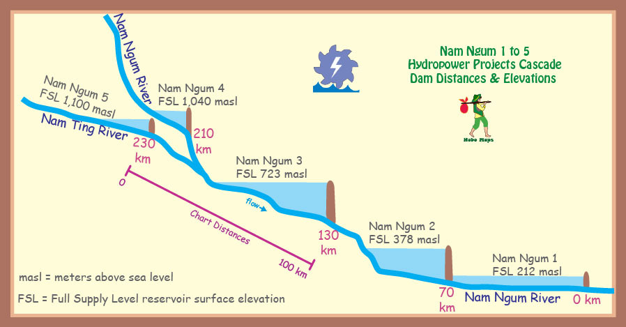
At Full Supply Level (723 masl) the surface area of the reservoir is 27.5 square km and its length is about 55 km. The reservoir is to have 1,411 million cubic meters capacity.
At the Minimum Operation Level (660 meters above sea level) the surface area of the reservoir will cover an area of 9.4 square km. A very large drawdown capacity with this 63 meter difference between Full Suppply Level and Minimum Operation Level.
Red line in map below shows a 10.6 km underground headrace tunnel between the Nam Ngum 3 dam site and the powerhouse.
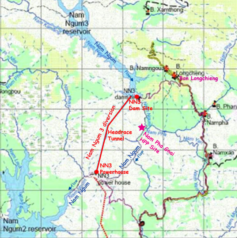
The powerhouse is located 10.6 km southwest of the dam structure on the right bank of Nam Ngum.
The plant has three 160 MW vertical Francis turbine-generator sets designed to operate with a head of 340 meters.
The project has three sets of 200 megavolt ampere air-cooled transformers along with ancillary equipment, circuit breaker cabinets, 24 kV high voltage switchgear and a 115 kV switchyard.
The electricity generated by the Nam Ngum 3 hydroelectric power plant was planned to be transmitted through a 110 km-long, double-circuit 230 kV power transmission line connected to the Ban Naphia or Nabong substation. Most or all of the electric output from the Project was to be exported and sold to Thailand. The Thai government originally agreed to buy the output but a formal PPA was never signed. However, on 8 February 2025 the Bangkok Post reported that Thailand now has decided not to buy any power from Nam Ngum 3 HPP due to financial considerations.
According to the ADB 2012 Resettlement & Ethnic Minority Development Plan, 758 households may be physically and/or economically impacted by the project.
Nam Ngum 3 dam structure images below located at coordinates 19°04'58.8"N 102°52'40.8"E (19.083, 102.878):
Images below shows the Nam Ngum 3 powerhouse site near coordinates 19°00'11.0"N 102°49'25.1"E (19.003059, 102.823636):
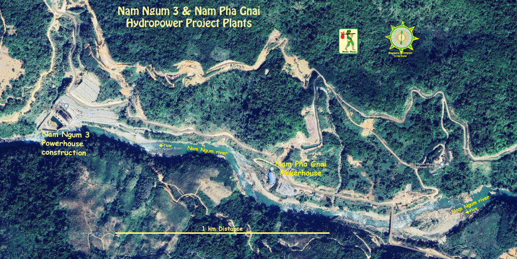
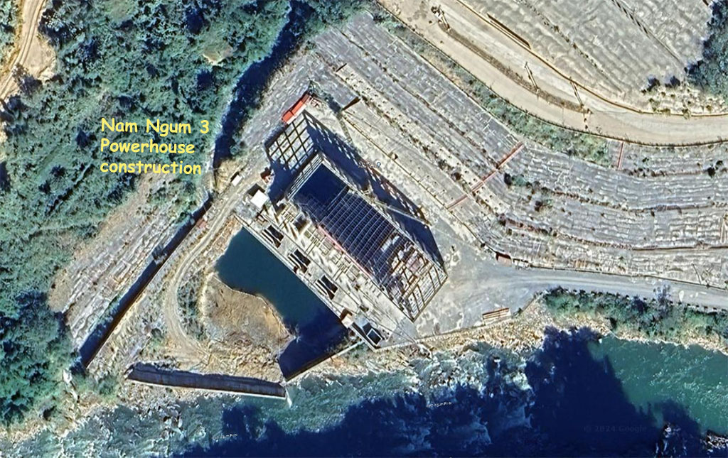
Image below shows Nam Ngum 3 & Nam Pha Gnai plant sites:
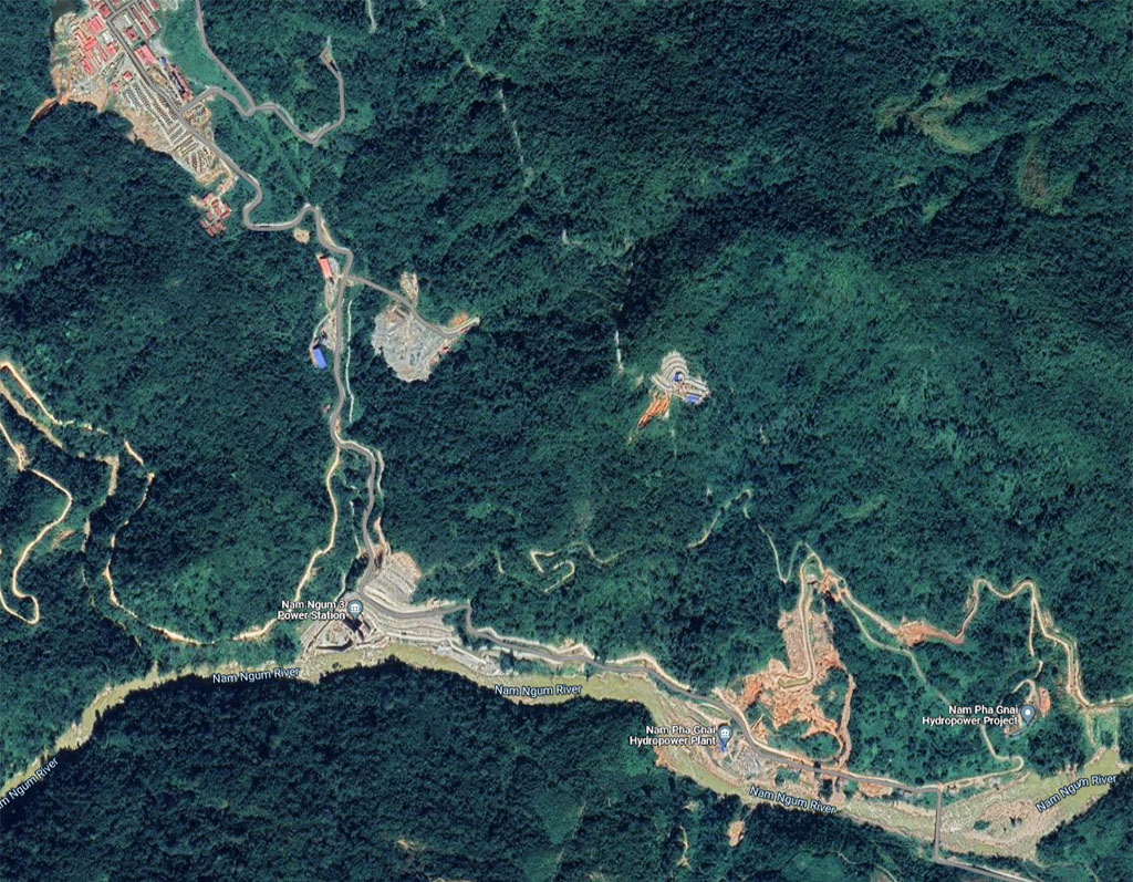
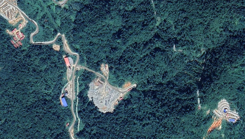
Image below may show Nam Ngum 3 surge tank at bottom right of image but it's not verified yet.
Nam Ngum 3 topographic map image below:
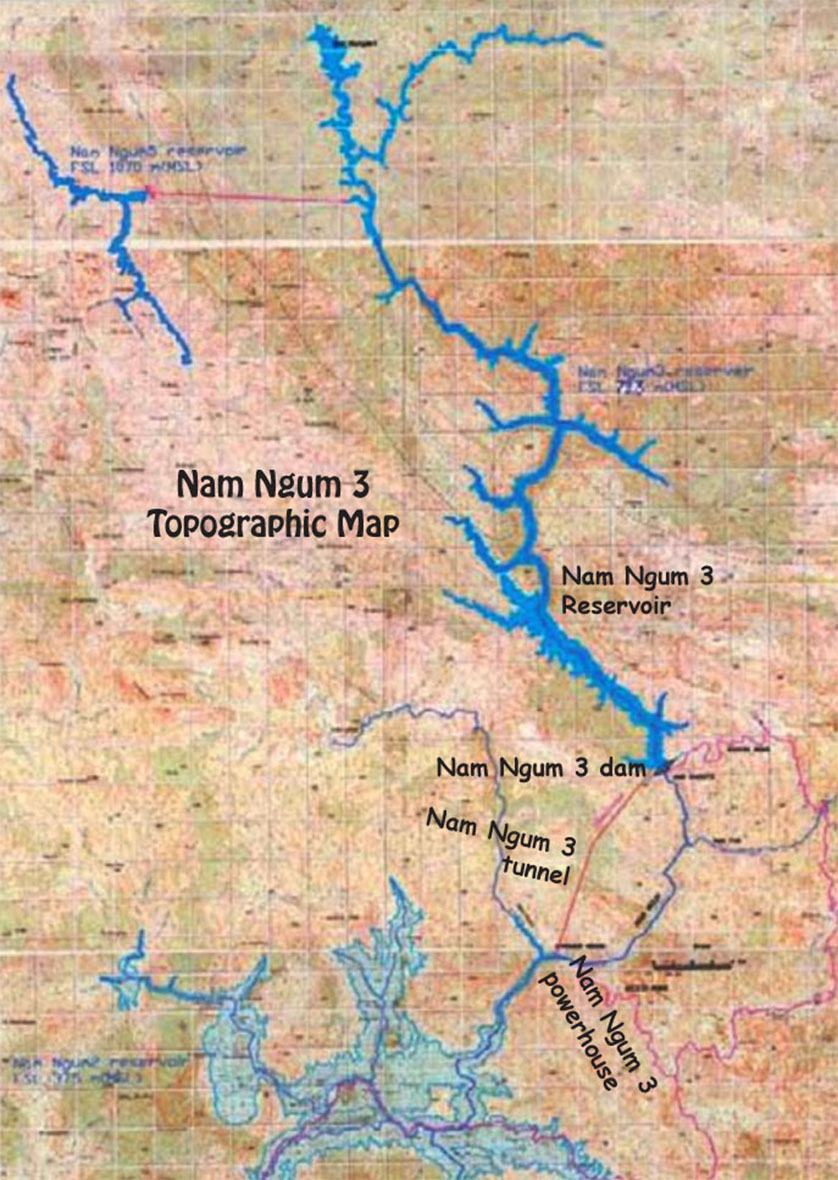
Nam Ngum 3 Dam shown in mid section of map below:
Nam Ngum 3 project details in chart below:


Nam Ngum 3 reservoir elevation of 723 meters above sea level as shown in chart below.
Steep and deep valley behind Nam Ngum 3 Dam below. The yellow line might represent Full Supply Level of the reservoir or the top of the dam structure.
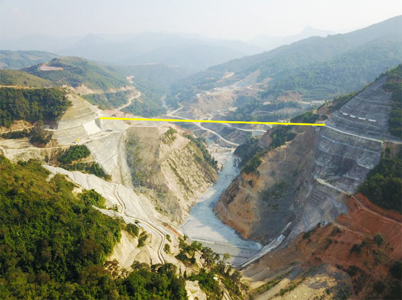
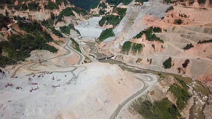
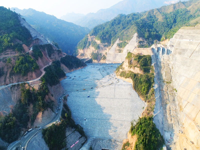
Nam Ngum 3 project construction site images below:
Nam Ngum 3 project location shown in Nam Ngum Basin map below:
Contractors Involved
Sinohydro International Engineering Company signed an engineering, procurement, and construction (EPC) contract for the development of the Nam Ngum 3 hydroelectric power project in 2013.
China Hydropower Construction International Engineering, and China Water Resources, and the Tenth Bureau of Hydropower were subcontracted for the construction works of the project.
Zhefu Company was contracted for the manufacturing and supply of the main hydraulic equipment for the project
Sichaun Ertan International Engineering Consulting Company was engaged by Sinohydro to provide supervision services.
East Asia Investment and Construction Consultant has been engaged as the owner’s engineer and construction supervision contractor.
Right Tunnelling Company is responsible for the construction supervision of the headrace tunnel, dam grouting, and slope protection works.
Artelia France was engaged to provide the project owner’s consultancy services, while Northwest Survey and Design Research Institute was engaged in the design and engineering works of the project.
Nari Group Corporation procured the dam measuring instruments while Siam Tone Company was responsible for the installation of the instruments.
Sichuan Tuojiang Crane Company was subcontracted by the Tenth Bureau of Hydropower for the procurement of the gantry crane, while Yiante Construction provided formworks for the spillway construction activities.
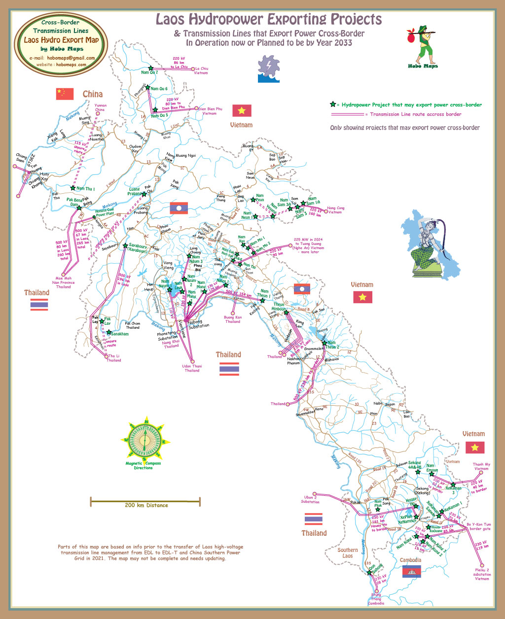
Nam Ngum 3's export of output to Thailand may be by route shown in map below but not yet confirmed. See enlarged version HERE.
The Asian Development Bank (ADB) was involved with the Nam Ngum 3 project planning around years 2011 & 2012 and detailed reports of the proposed project were prepared such as Environmental Impact Report, Project Details Report, Resettlement Plan, etc. These reports are on the web for download but since the project has been revised, they should be read with caution.
Nam Ngum 3 Hydropower Plant feasibility study was approved on March 25, 2014.
On July 9, 2014, the Environmental Certificate was obtained.
In June 2014, the project’s Natural Environment Management and Monitoring Plan was completed.
In August 2014, the project’s Environmental Impact Assessment Report was completed.
History below copied from ADB REMDP report issued around 2011 before they were removed from the project:
The Nam Ngum 3 Project was identified by the Mekong Secretariat in the 1970s as a potential hydropower project. Developers were selected to develop the site under a Memorandum of Understanding signed with GoL in 1994. The feasibility study, including environmental studies, was finalized by Snowy Mountains Engineering Corporation Limited and Southeast Asia Technology Company Limited in 1995. Resource Management and Research was engaged in 1998 to carry out an Impact Analysis to provide the Developer with detailed Social Action and Environmental Management Plans. These documents were used as a basis for two rounds of public workshops in 2002 and resulted in environmental approval by STEA allowing the Developer to start construction. However, the SE Asia financial crisis in 1997 & after interrupted the development until 2006. By that time, the environmental and social baseline situation had changed and required an update of the environmental and social documentation, which was undertaken from 2007 to 2009 by EcoLao and Norplan.