Pak Beng Mekong Dam Hydropower Info by Hobo Maps - Go to Hydropower Projects Page - - Home
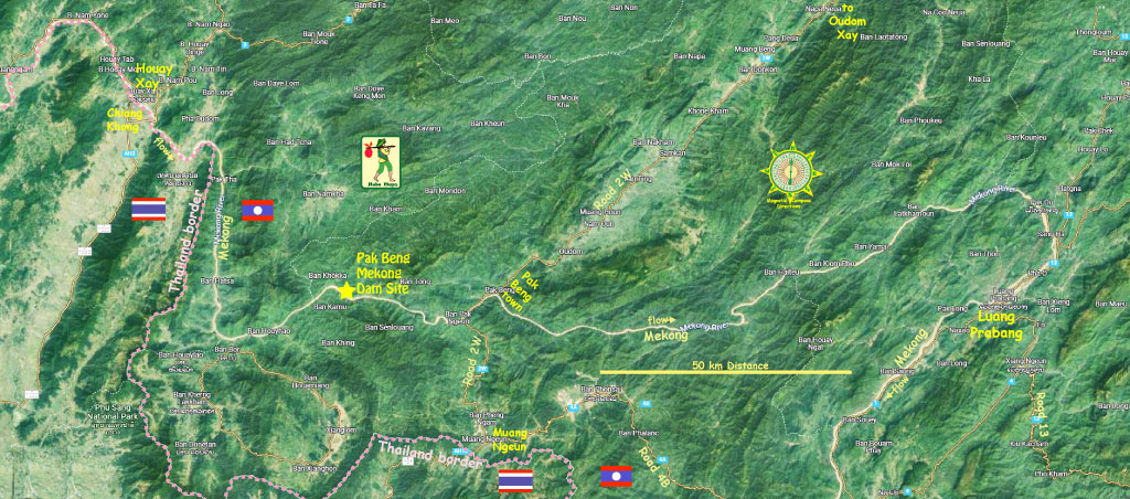
The Pak Beng Mekong Dam hydropower project is on the mainstream Mekong River about 35 km upriver from the town of Pak Beng, Pak Beng District of Oudomxay Province, Lao PDR.
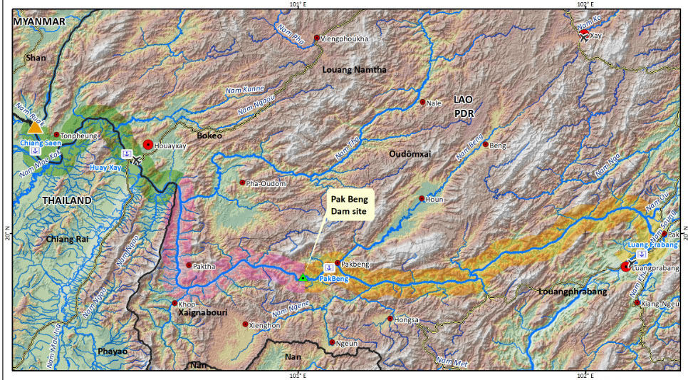
Pak Beng Dam location below at coordinates - 19°53'45.6"N 100°49'37.2"E (19.896 100.827).

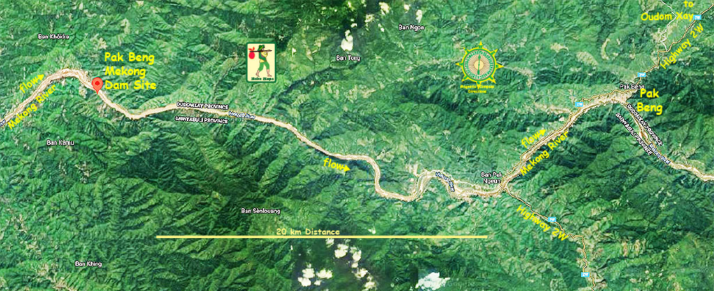
The hydropower project is a run-of-river type that would not have a large reservoir but raise the water level of the Mekong River behind the dam into a head pond with a surface level just below the river's historic flood level. The head pond is designed to be contained within the riverbanks without inundation of land outside these banks. The backwater reservoir may extend up to 97 km upriver on the Mekong, taming the natural flow and creating a pond similar to a lake that will eliminate rapids and whirlpools.
The project is being developed by the Datang (Lao) Pak Beng Hydropower Co. (China Datang Overseas Investment Co.) and Gulf Energy Development Public Company Limited as Co-Sponsors.
Ownership of the Pak Beng project is planned to be a joint venture registered in Lao PDR, with China Datang Overseas Investment Co., Ltd. holding 51% of the shares and the Thai company, Gulf Energy Development Public Co., Ltd. holding 49% of the shares.
On April 25, 2022 the two shareholders entered into a tarrif MOU agreement with Electricity Generating Authority of Thailand (EGAT) to set a planned rate for export of power to Thailand.
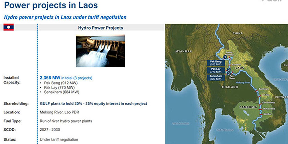
The power plant will consist of 16 bulb turbine-generator sets of 57 megawatts (MW) each for a total installed capacity of 912 MW. The annual average energy production capacity is estimated at an optimistic 4,765 gigawatt hours (GWh). The plant is expected to produce 1,818 GWh in the dry season from December to May and 2,947 GWh in the wet season from June to November.
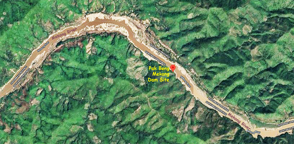
Pak Beng Mekong Dam site image below before start of construction.
The construction is expected to take five years and cost around $ 2.372 billion USD.
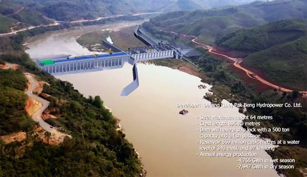
The dam structure would be 64 meters high and 896 meters long with crest elevation at 346 meters above mean sea level.
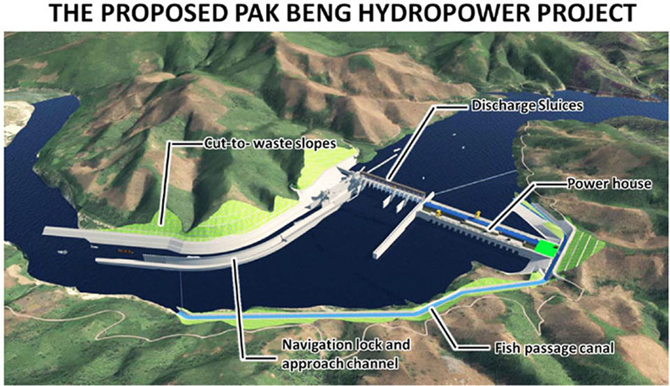
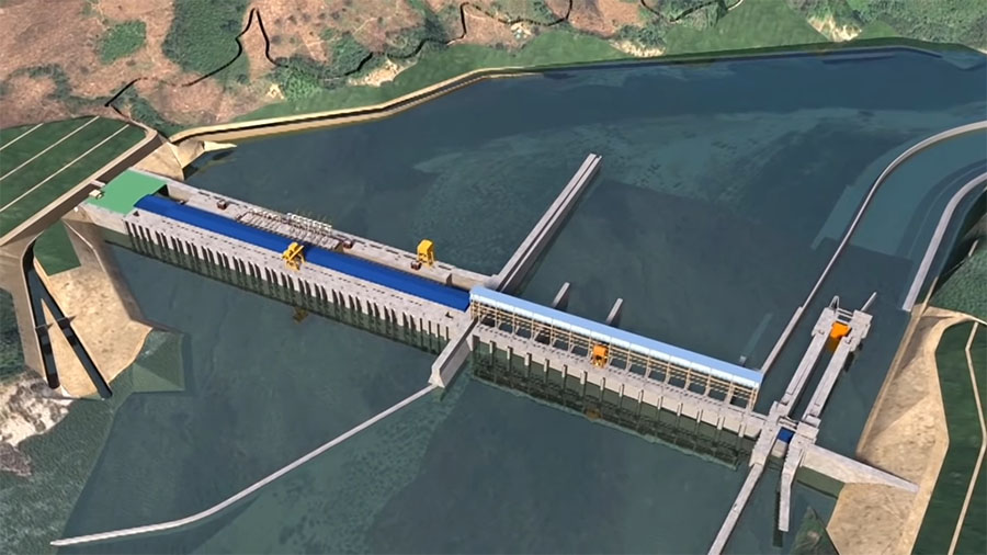
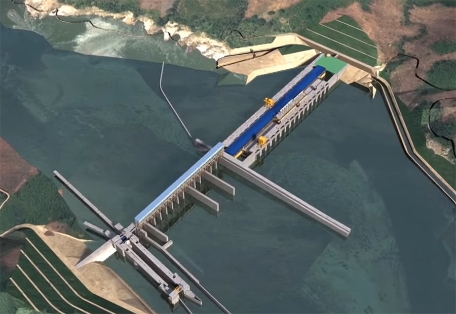
The powerhouse is on the left side of the main river channel looking downstream. The discharge sluices are located on the right terrace and the ship lock is arranged on the right bank.
The main powerhouse is on the left side of the main river channel while an auxiliary powerhouse is located downstream of the main powerhouse.
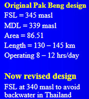
The reservoir capacity of the project will be 559 million cubic meters at a maximum water level of 340 meters above sea level (masl).
Pak Beng Dam proposed location shown below:
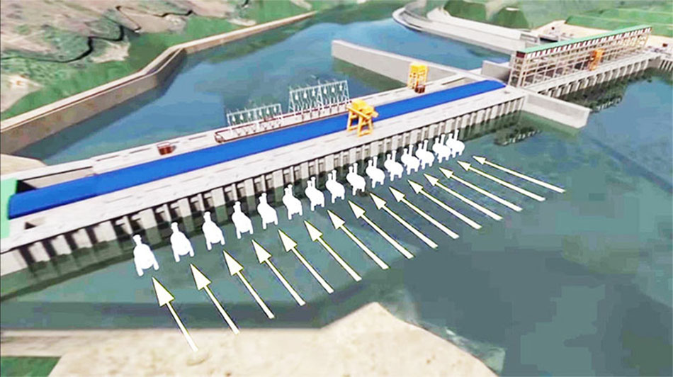
The water-retaining structures include a gravity dam, powerhouse, discharge sluices and a ship lock. The flood release structures include outlets and 14 discharging sluices 15 meters wide and 23 meters high each. A stilling basin will be created behind the sluices to dissipate the energy of released water. Sand outlets will be between every two generating units.
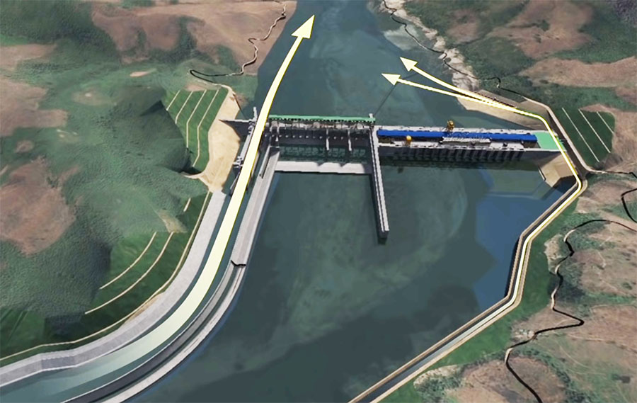
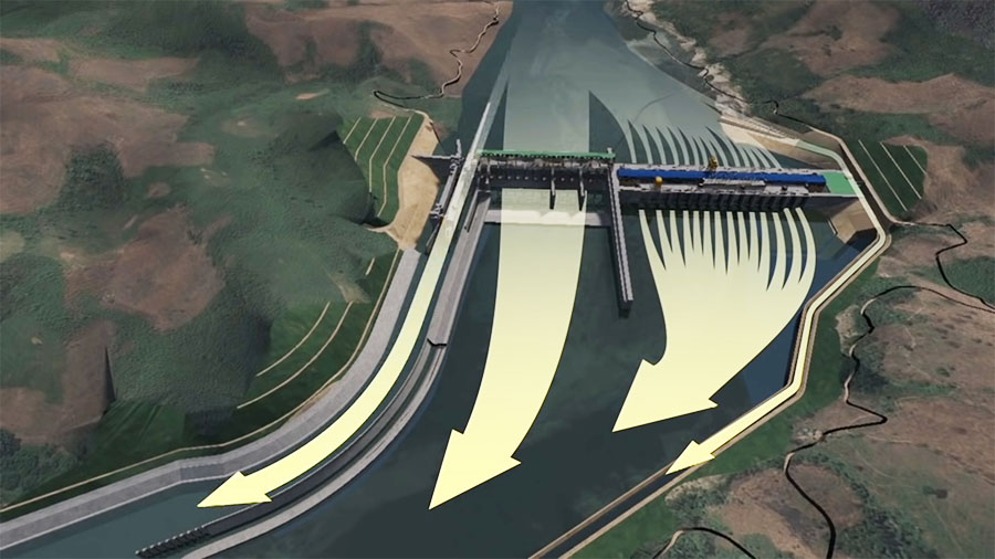
The fish passage channel is on the left bank and consists of a channel 1.6 km long with a U shape in the upper reaches. Several pools will be set along the channel to serve as resting places. An observation room would be set downstream of the service gate for fish counting, observation and trapping.
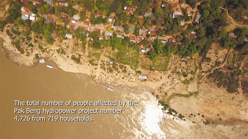
The Social Impact Assessment has identified 26 villages in Oudomxay and Bokeo provinces in northern Laos that would be directly impacted by the project and includes 923 households and 4,726 people.
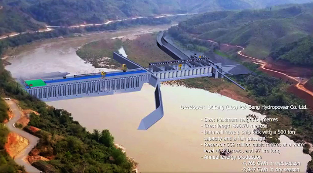
Conceptual images of what the dam project would look like during construction are below:
Caution: The original design of the Pak Beng Mekong Dam has been changed and some older info on the web is out-of-date. One change was to lower the elevation of the dam structure and the reservoir to avoid reservoir water from impacting any land in Thailand.
Up to 10% of the power produced by the project was planned to be sold to Electricite du Laos (EDL) and the rest is to be supplied to Thailand.
In March 2022 Thailand energy authorities announced that EGAT will execute a long term Power Purchase Agreement (PPA) to purchase electricity from the Pak Beng hydropower project.
On April 25, 2022 EGAT signed a Tariff Memorandum with Datang (Lao) Pak Beng Hydropower Co. and Gulf Energy Development Public Company Limited (GULF as the Project Co-Sponsor) in which EGAT agreed to purchase power from the project at an agreed rate.
On 13 September 2023 the PPA for the Pak Beng HPP was signed for a duration of 29 years with the export and sale of 95% of the plant's output to commence in 2033 at 2.70 baht per unit.
Thai energy company Gulf Energy PCL plans to purchase a 30% to 35% ownership interest in the Pak Beng hydropower project.
The flood release structures of the plant will include outlets and 14 discharging sluices of 15 meters wide and 23 meters high each. A stilling basin will be created behind the sluices to dissipate the energy of released water.
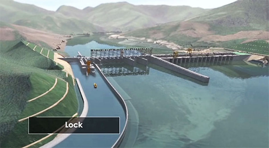
The navigation structure will allow for the navigation of 500 ton ships and will have space to upgrade the one-way one-step ship lock design into a double-way lock in the future. The navigation lock will have a working head of 32.38 meters and a lock chamber 20 meters long and 12 meters wide.
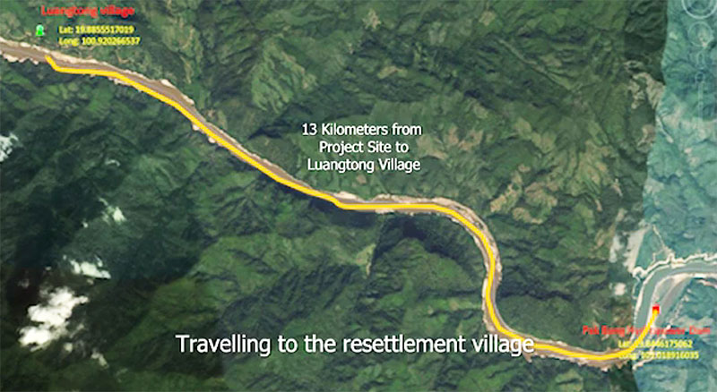
The project will require resettlement of the entire village of Ban Luangtong which is located 13 km upriver from the dam structure as well as other local people.
Resettlement image below.
Arrows in image below show fish passage upriver routes.
Arrows in image below show fish passage downstream routes.
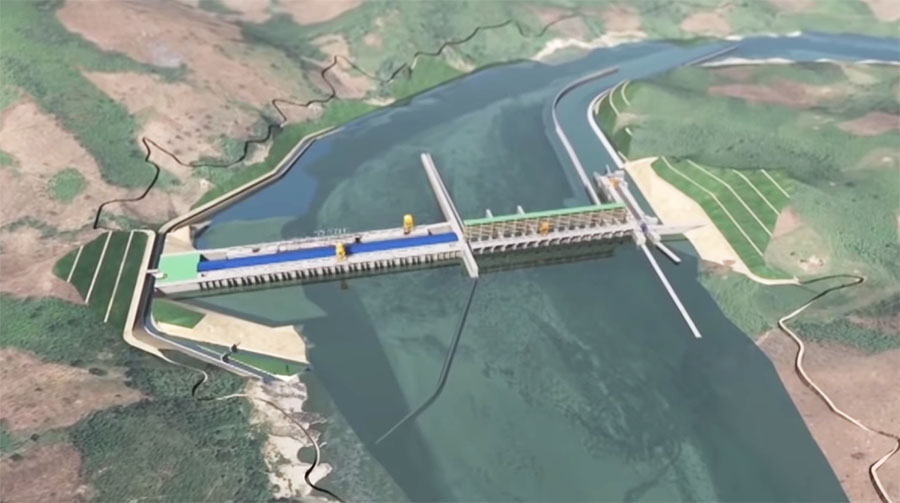
More Pak Beng Dam concept images below:
On 4 November 2016, the Lao National Mekong Committee Secretariat submitted the detailed description of the planned project to the Mekong River Commssion (MRC) Secretariat for its review and further action to inform the other member countries about the Pak Beng project’s scope and other requirements under the prior consultation process.
This first meeting of the Notification, Prior Consultation and Agreement (PNPCA) on 12 January 2017 informed and discussed several key issues to ensure successful implementation of a six-month prior consultation process of the proposed Pak Beng hydropower project with the aim of increasing the joint benefits and cooperation among member countries and MRC Secretariat.
Maps below show a possible route for transmission line to export project output to Thailand.
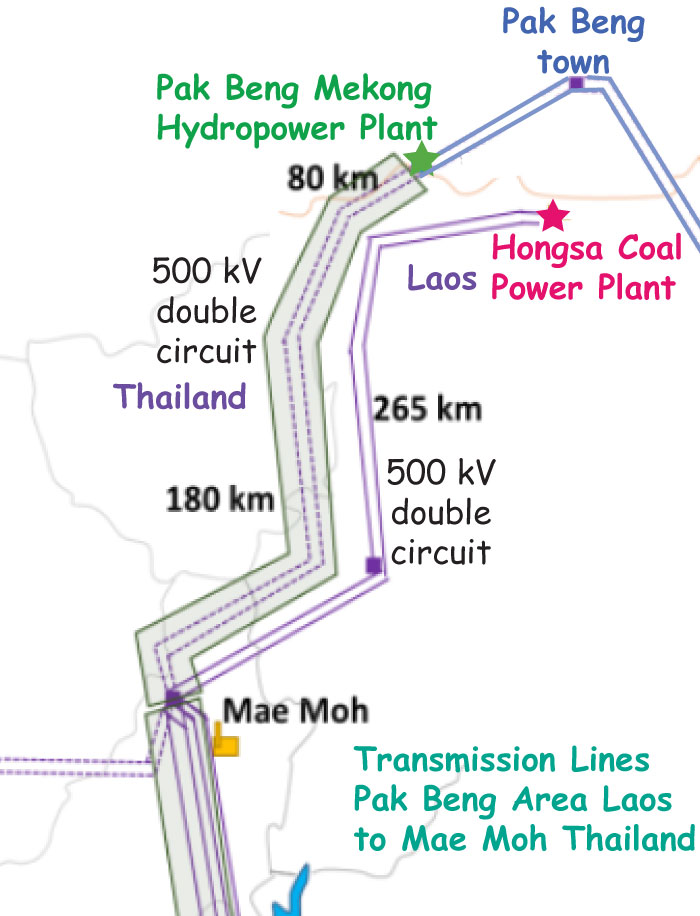
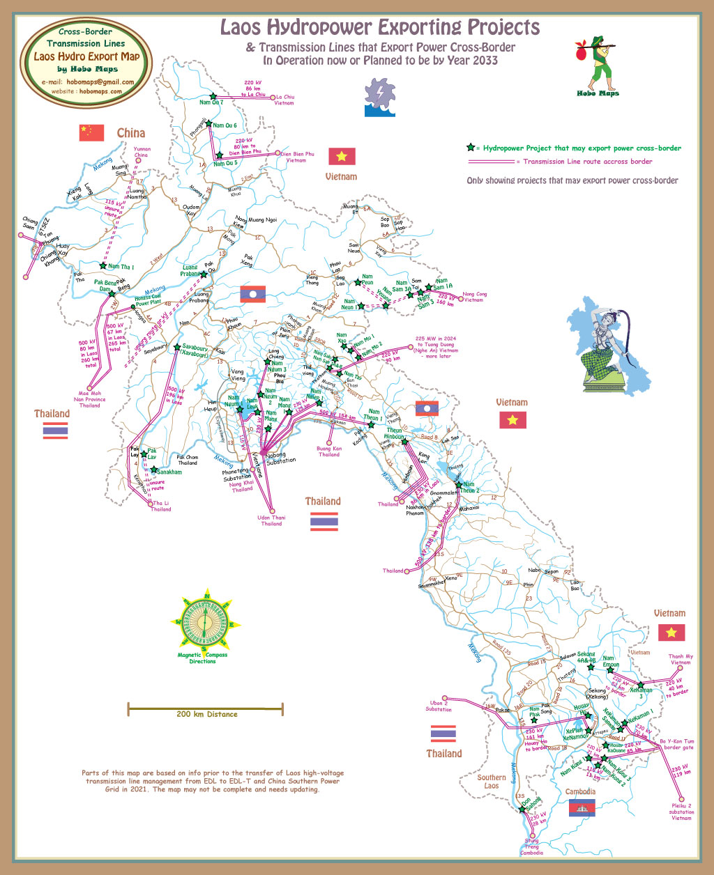
Pak Beng Dam connects to transmission line for export to Thailand in map below at upper left side. See enlarged version HERE
Resettlement info below:
