Pak Chom Dam Hydropower Info by Hobo Maps - Go to Hydropower Projects Page - - Home
In the original 2008 proposal, the Ministry of Energy Thailand and Ministry of Mines and Energy Lao PDR would jointly undertake the Pak Chom Hydropower Plant project to be located on mainstream Mekong adjacent to Loei Province in Thailand and to Sangthong District in Vientiane Province, Lao PDR.
The project is still in a planning stage in 2024 and the project has not submitted a request to the Mekong River Commission to start the PNPCA six month prior notification procedures.
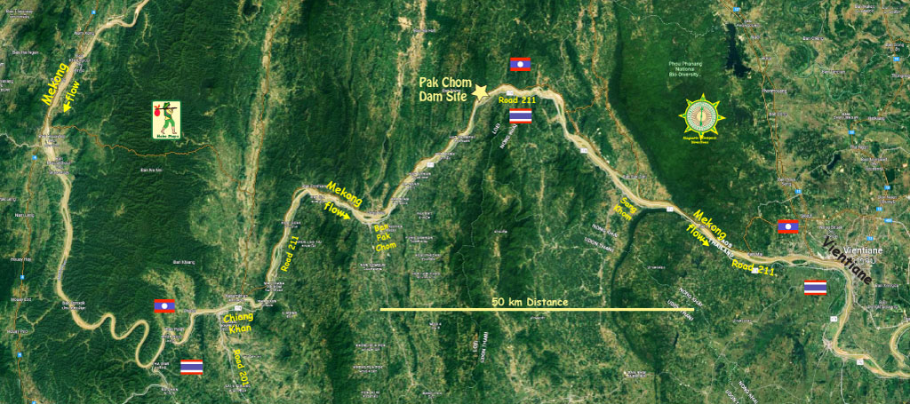
The location of the project is to be adjacent to Ban Huai Khop, Hat Khamphi Sub-district, Pak Chom District, Loei Province, Thailand and near Ban Huai Hang, Sangthong District, Vientiane Capital Province, Lao PDR. - 18°12'12.00"N 102° 3'0.00"E (18.203333, 102.050000)

Concept image below of what the Pak Chom Dam structure may look like:
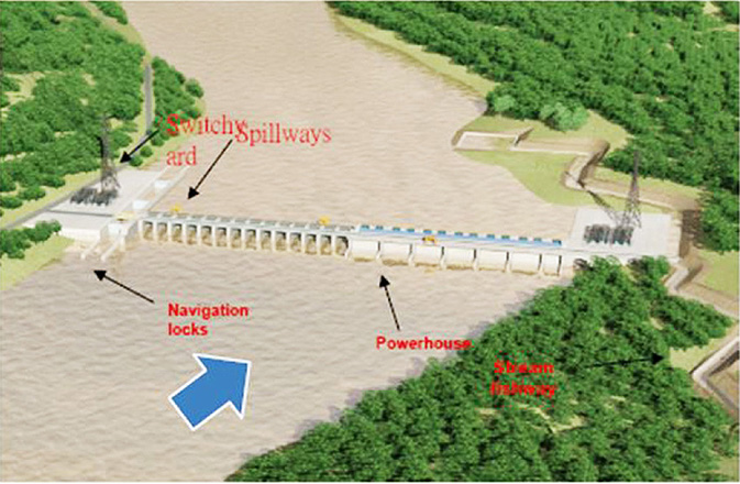
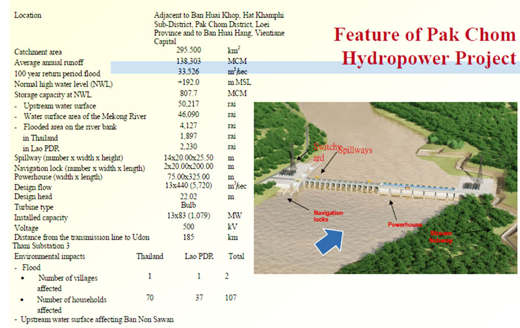
The barrage dam structure would be concrete gravity type with a height of 55 meters and length of 1,200 meters. The rated head is about 22 meters.
13 turbine generator units at 83 MW each are planned with total installed capacity at 1,079 MW. Potential energy generated is estimated at 5,318 GWh per year. The plant mode of operation is to be continuous generation and not for peaking mode.
The Pak Chom Dam is a trans-border project affecting land and waters in both Thailand and Laos. Difficulties in managing a cross-boundry project have yet to be worked out. The plan was to sell 90% the power output to Thailand and a 185 km transmission line was proposed to transmit output to Udon substation in Thailand.
Proposed location in image below:
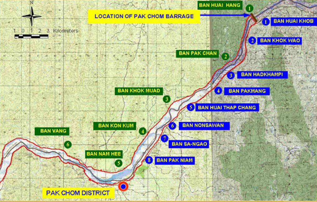
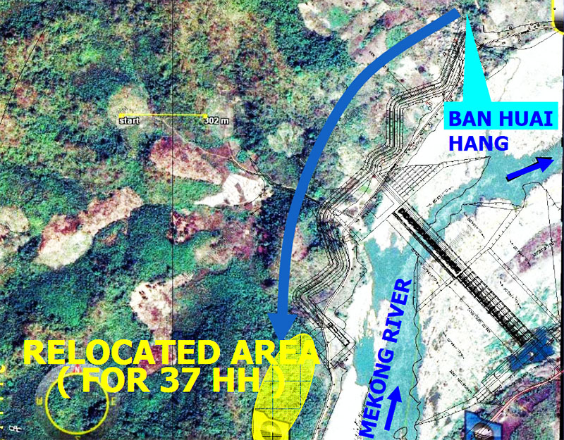
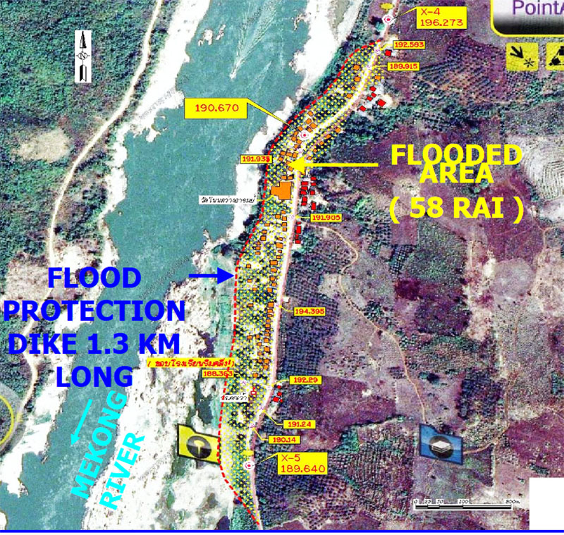
The proposed Pak Chom Dam reservoir would inundate lands in both Thailand and Laos. The total area of agricultural land expected to be inundated is 128 hectares in Thailand and 88.5 hectares in Laos. 2 villages (1 Lao, 1 Thai) containing 107 households and 535 people would need to be resettled. Construction would affect about 250,000 people on both sides of the border.
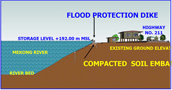
The area inundated by the reservoir at full supply level 192 meters above sea level would cover 73.54 sq km with 807 million cubic meters active volume. The length of the reservoir would extend 80 km upriver.
Navigation locks are planned for transit of vessels up to 500 tons with 2 lock capacity, 200 meters long and 20 meters wide.
Estimated cost of the project is US $1.764 billion
Pak Chom Dam feature details in image below:
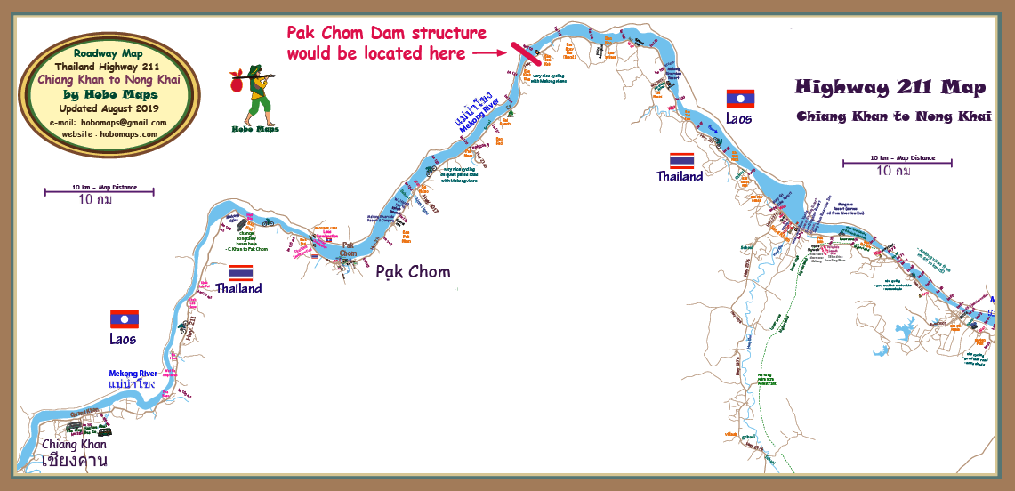
Location of Pak Chom Dam structure shown on Thailand's Highway 211 Map below:
Click to see full version of Highway 211 Map
