Thakhek Loop Geographic Map Laos - by HoboMaps.com - - - Home
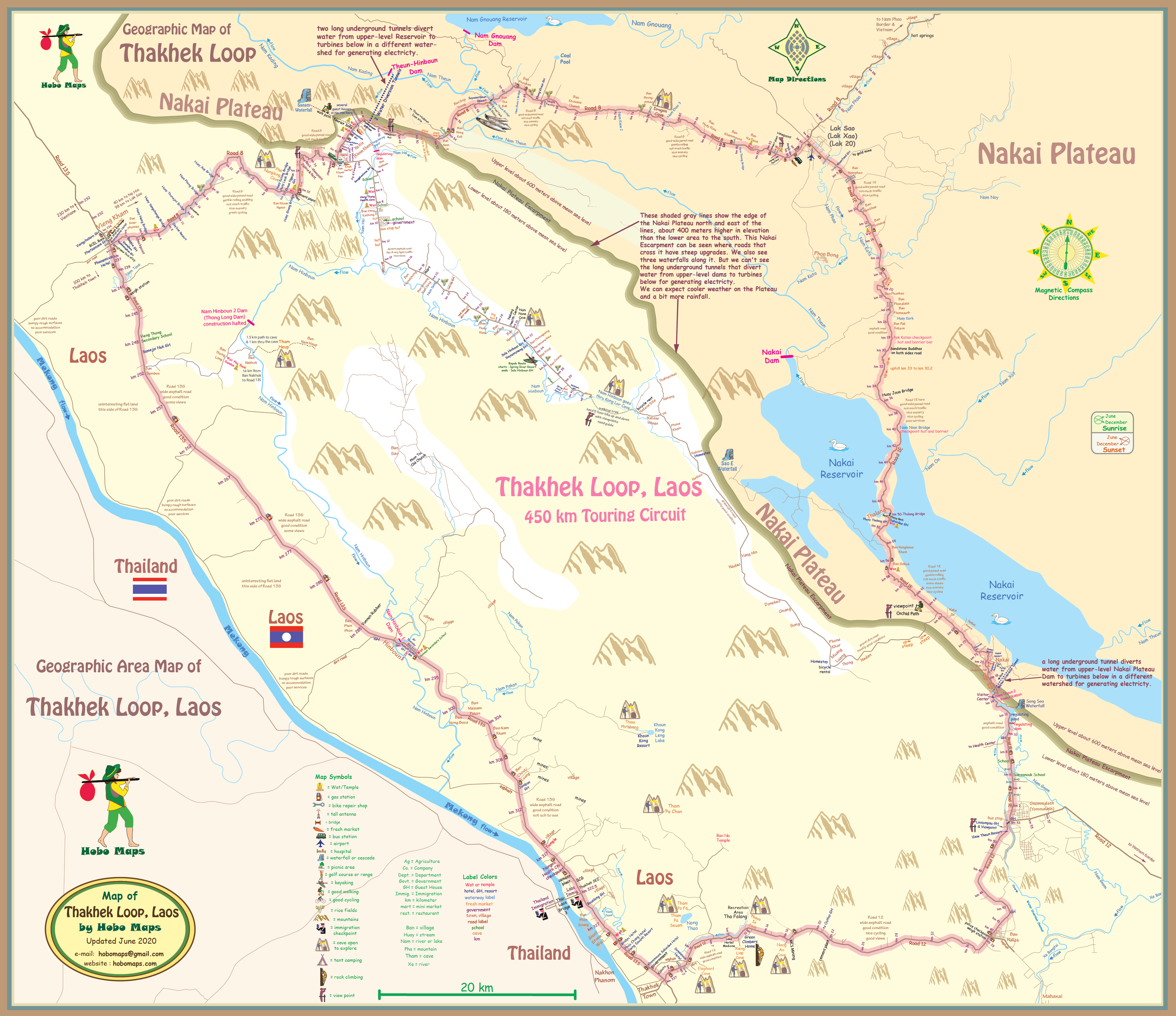
The famous Thakhek Loop cycling area has an abrupt land elevation change (escarpment) of about 400 meters on the north and east sides of the Loop as shown on the map below. A Loop cycler might notice the elevation change at 3 steep uphill grades on the roads and at 3 waterfalls along the edge of the plateau.

The Thakhek Loop Geographic map is also available in PDF format for off-line viewing on computers, tablets & mobiles - $1.00 each - click HERE for info
Click HERE to see our web page with detailed info and images of the major dams in the area of the Loop
Click HERE to see our Thakhek Loop Terrain Map
Click HERE to see our Thakhek Loop Drainage Map
Click HERE to see our Nakai Map